Digital map for use exclusively in the Avenza Maps app
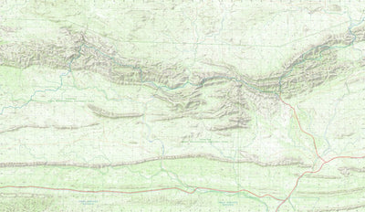
West MacDonnell Ranges and the Larapinta Trail (Map 2: The Chewings Range)
This product can also be purchased as part of the following bundle(s).
$9.99 USD
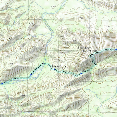
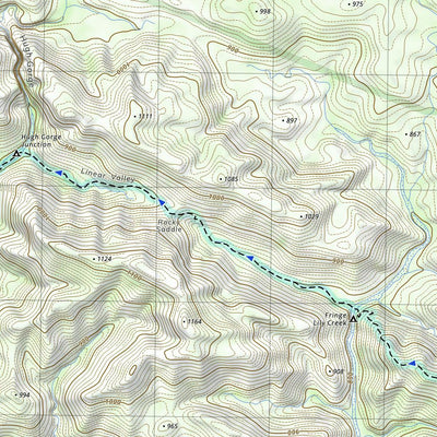
A topographic map series covering the West MacDonnell Ranges at 1:40,000 scale, including the entire length of the Larapinta Trail. This map covers sections 3–6 of the trail, including Jay Creek, Standley Chasm, Brinkley Bluff and Hugh Gorge.
Elevation is depicted by contours at 20-metre inter...
Elevation is depicted by contours at 20-metre inter...
Geographic area:
Category:
Topographic
Size:
44.45MB
Publication:
February 2020
Language:
English
This product is available exclusively in digital format, for use only in the Avenza Maps app.
Map bounds
Check nearby mapsWhat you get with Avenza Maps

Reliable mapping tools
Record GPS tracks, add placemarks, add photos, measure distances, and much more.

Locate yourself with GPS
Avenza Maps offline GPS app on your mobile device can locate you on any map, without WiFi or network connectivity.

The best maps by the best publishers
Download professionally curated digital maps on the Avenza Map Store from the best-renowned publishers.