Avenza Maps. Powering work and adventure in the great outdoors. 1,000,000+ offline maps
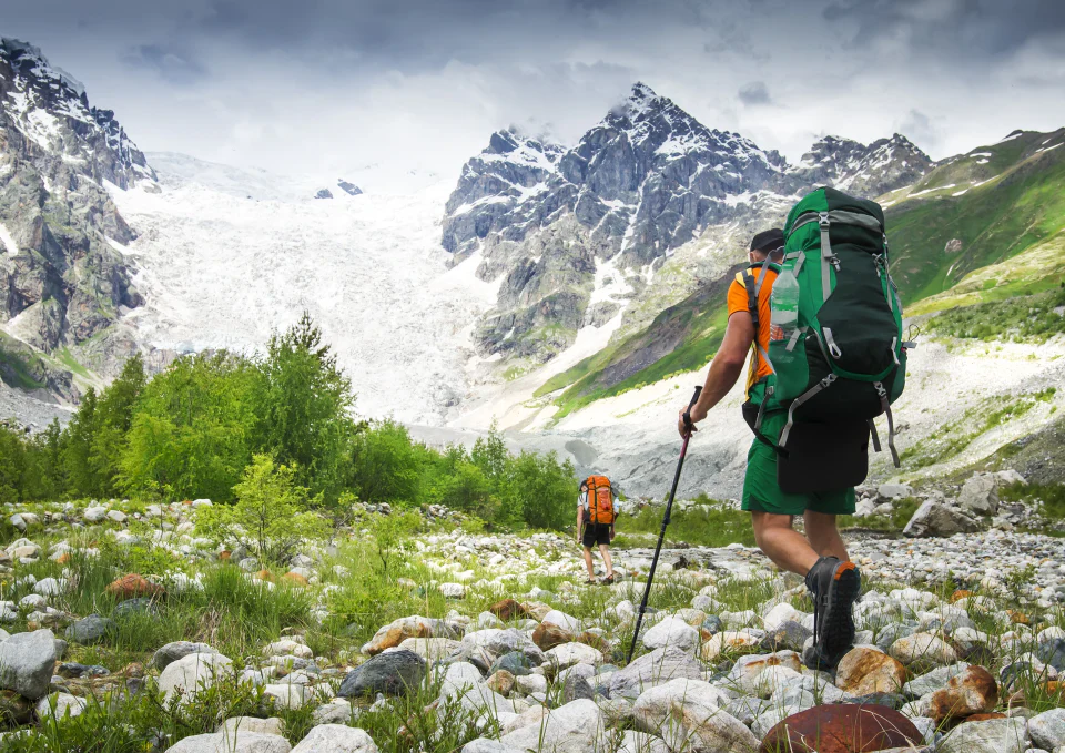
Take the app hiking, offroading, or anywhere you need a map outdoors. GPS location keeps you safe and on the trail.

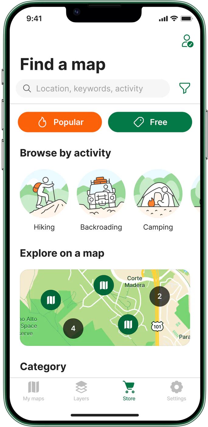

Find and discover maps in the Avenza Map Store
Discover maps of your favourite parks and trails in the Avenza Map Store. With the world’s largest digital catalogue of maps created by professional map publishers from around the world, you can find a map for any outdoor adventure. Download maps for hiking, biking, offroading, skiing, fishing, and much more!
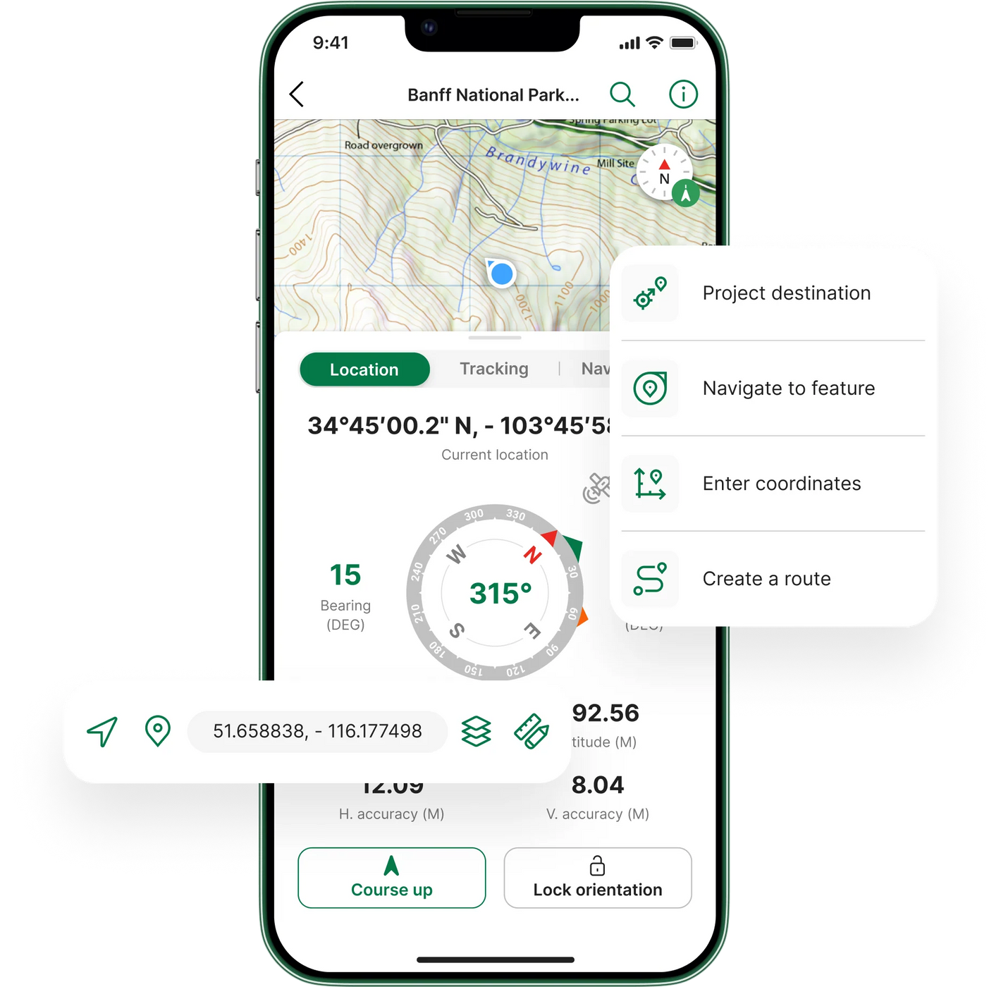
Locate yourself on any map, even while offline
The Avenza Maps® app uses your device's built-in GPS to display your exact location on any georeferenced map, even when you’re out of network range or without an internet connection. The blue dot follows you wherever you go, keeping you on the trail while staying safe.
Useful and interactive map tools
Planning a hiking trip or heading on an off-trail adventure? Avenza Maps mapping tools are handy for marking places of interest, attaching photos, and adding information to locations. Measure distances, plot routes, and record your tracks to document where you've travelled during your journey.
Determine and share your exact coordinates
Stay location-aware by knowing your exact coordinates at any time. Accurately locate yourself and other points of interest on detailed maps, and easily share that information with family or friends in case of emergency. Search for specific coordinates on any map and switch between coordinate formats.
Stay on track with more Avenza Maps features
Stay in or out of map areas
Mark places of interest with a pin
Search for places
Discover details of your trip
Add geotagged photos on a map
Measure distance between points
Organize features with layers
Reach new destinations with what3words
Organize maps with folders and collections

Avenza Maps Pro features

Import unlimited maps
Download your maps over a Wi-Fi or cellular network. Avenza Maps Pro allows unlimited imports of personalized geospatial PDF, GeoTIFF, GeoPDF®, and JPG (with appropriate reference files).
Shapefile and area support
Add shapefiles directly to your map to work with points, lines, and areas. Easily convert your collected GPS Tracks into an area. Use the Draw and Measure tool to create areas and export to shapefile when ready to share.
Collecting data on maps
Easily record attributes at any placemark or track. Add custom fields, insert field values, modify location, change color, and add notes and geotagged photos. Import and manage custom symbol sets to use with your maps and set default symbols to be used on layers while collecting data.
Learn more about Avenza Maps Pro