
Avenza Maps Pro for Government Use
How Can Avenza Maps Help You?
Mapping technology for government is essential to visualize information, aid operations, maintain and organize data, and help plan better communities and promote civic engagement. Today, the demands of having proven and effective solutions at your government's disposal while being fiscally responsible are ever-increasing. Avenza Maps is a cost-effective platform that enables you to align your mapping needs with your existing enterprise organizational needs.
The flexibility of our mobile app allows your field staff to import custom maps created by your team, group them as a collection for seamless browsing, and use them in the field fully offline when away from network coverage. Create and share custom collection schemas to take inventory of urban features, rural areas, and other relevant points of interest. The app allows you to export this data and upload it to your own network or a cloud storage solution for analysis by your office staff.
Providing proven technology to drive change is a high priority. The Avenza Maps platform provides your team with a more organized and managed way to use maps at all government levels and grants the ability to access data immediately enables better decision making.

What We Offer

Works without a connection
Locate yourself and collect data
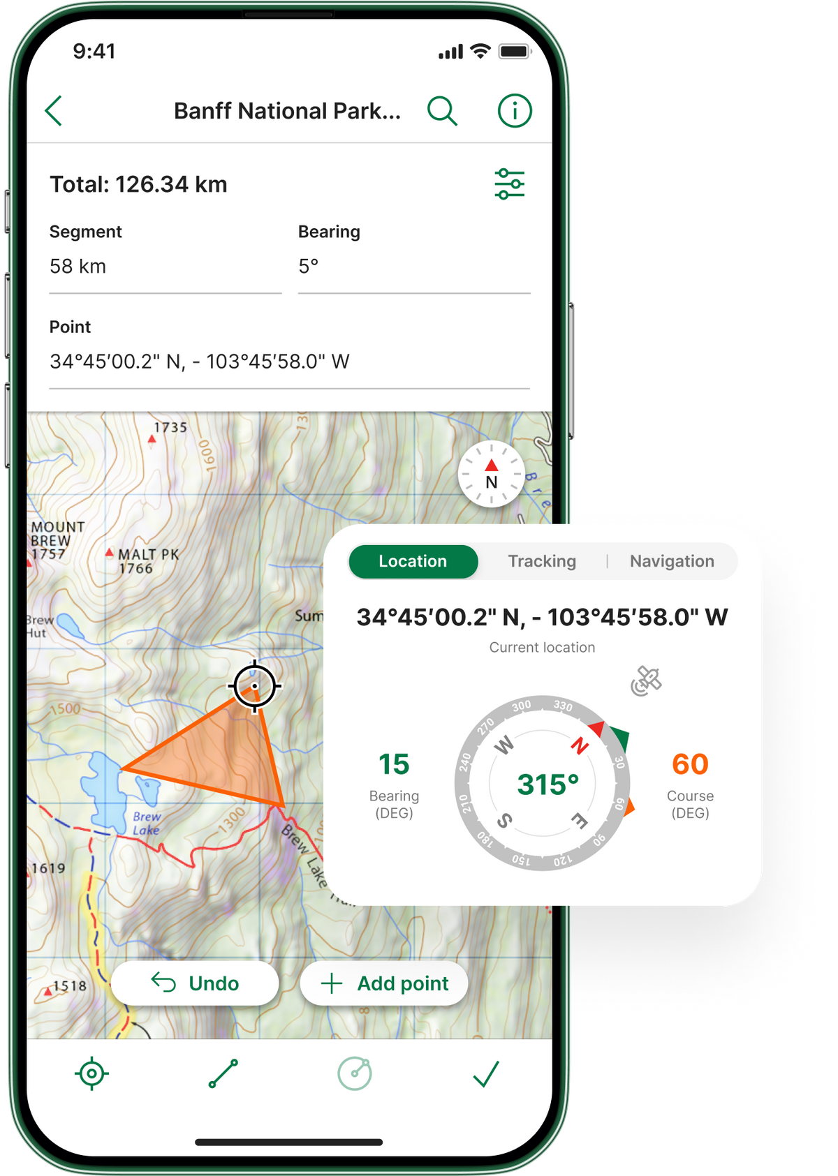

Import custom maps

Shapefile and area support
Works without a connection
Import custom maps
Locate yourself and collect data
Shapefile and area support
Case Study Insights

Wildland Fire’s Air Tactical Team

Michigan's Department of Transportation

United States Forest Service

Building Roads and Fighting Fires: Mobile Maps in Action

Albuquerque Balloon Festival Utilizes Avenza Maps
You're In Good Company