
Avenza Maps Pro for Utilities & Renewable Energy
How Can Avenza Maps Help You?
Whether you manage an electrical grid or wastewater pipelines, having detailed information about your infrastructure is crucial for your business. Avenza Maps has developed a cost-effective platform that enables you to align your mapping and field data collection needs with your existing enterprise business needs.
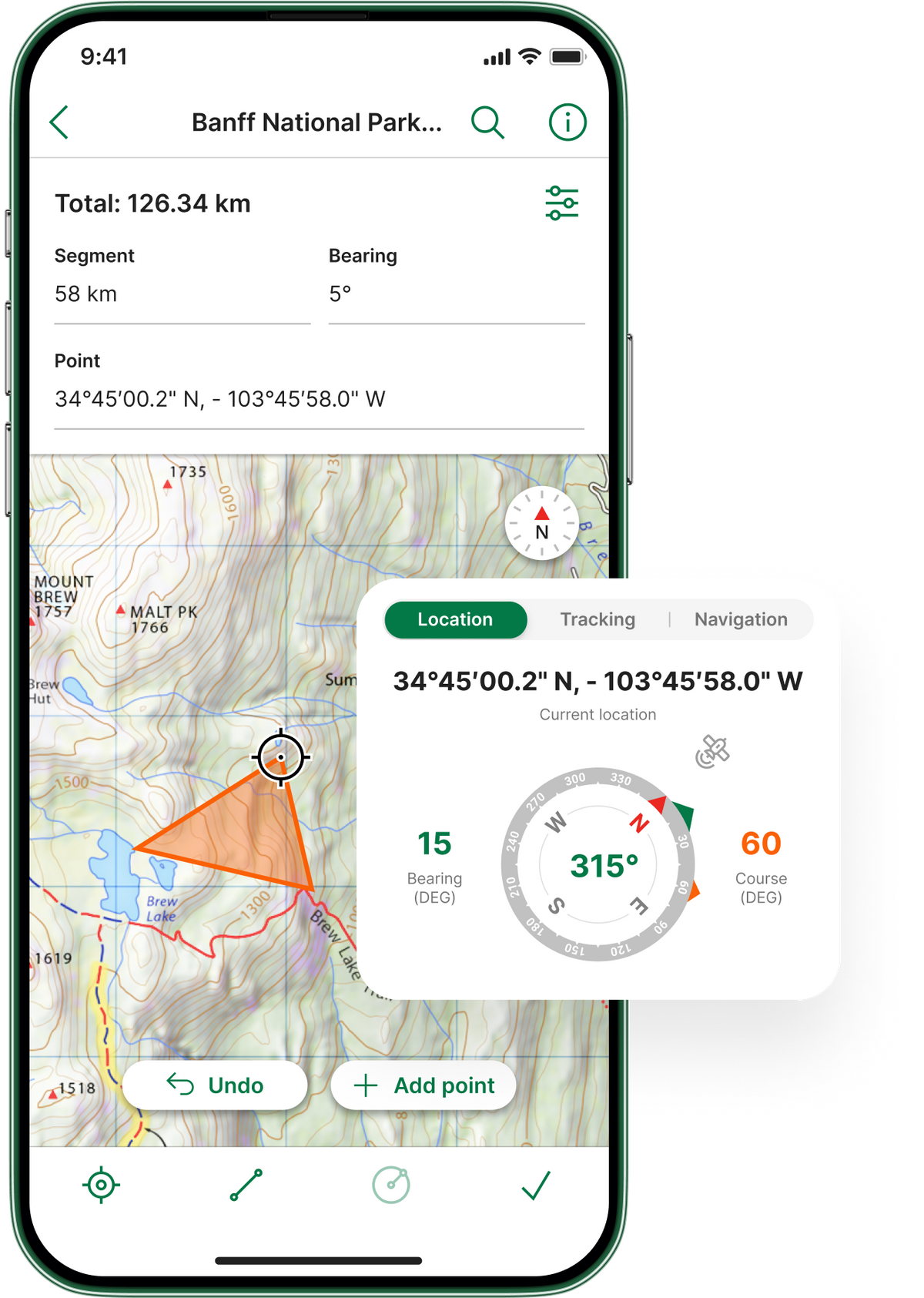
The flexibility of our mobile app allows you to import custom maps created by your team. Group multiple maps of an area as a collection for seamless browsing. Use maps fully offline when away from network coverage. Rely exclusively on GPS to precisely locate yourself and to collect points of data in the field. Capture details and photos at specific locations while inspecting and efficiently maintaining infrastructure sites. Create custom field collection schemas to take inventory of pipelines, towers, and other relevant points of interest. The app allows you to export data and upload it to your own network or a cloud storage solution.
Whether you're gathering location data of infrastructure access points or collecting and sharing data for inspection reports, the Avenza Maps mobile mapping app will help you get your work done faster and with greater accuracy.

What We Offer

Work without a connection
Locate yourself and collect data

Import custom maps

Shapefile and area support
Work without a connection
Import custom maps
Locate yourself and collect data
Shapefile and area support
Case Study Insights