Mapping the Peloponnese: A Community-Driven Trail Project with Anavasi Editions

Anavasi Editions has been producing detailed hiking maps since 1997 with a clear mission: to encourage people to explore Greece’s mountains and trails responsibly. Their work plays a critical role in supporting organized outdoor recreation, promoting sustainable tourism, and preserving natural landscapes. Over the years, they’ve refined their cartographic methods and built a rich geospatial database, always with an emphasis on working closely with local communities.
At Avenza Maps, we’re always excited to support projects that go beyond traditional mapping, those that empower communities and protect the natural world. That’s why we’re proud to highlight Anavasi Editions’ landmark initiative: a collaborative effort to map 1,730 km of hiking trails across Greece’s stunning Peloponnese region.
The Mapping Process
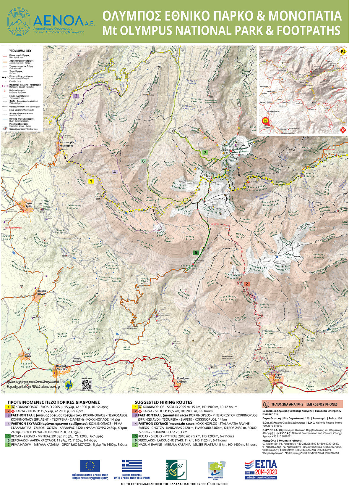
Before any boots hit the ground, the Anavasi team prepares preliminary digital maps. These georeferenced maps serve as precise digital basemaps. Once in the field, teams use Avenza Maps on their smartphones to track every twist and turn of the trails in real-time, capturing accurate GPS data along with trail difficulty, accessibility, and points of interest. So far, roughly 1,730 km across 14 distinct trail networks have been recorded through this method.
Once the field data rolls in, the data is integrated into Anavasi’s broader mapping system. This includes layering in existing background information: towns, roads, rivers, hiking trails, and place names. The maps are also aligned with Greek trail law and are used in the official trail certification process. These aren’t just lines on a map; they are officially recognized.
Power of Local Knowledge
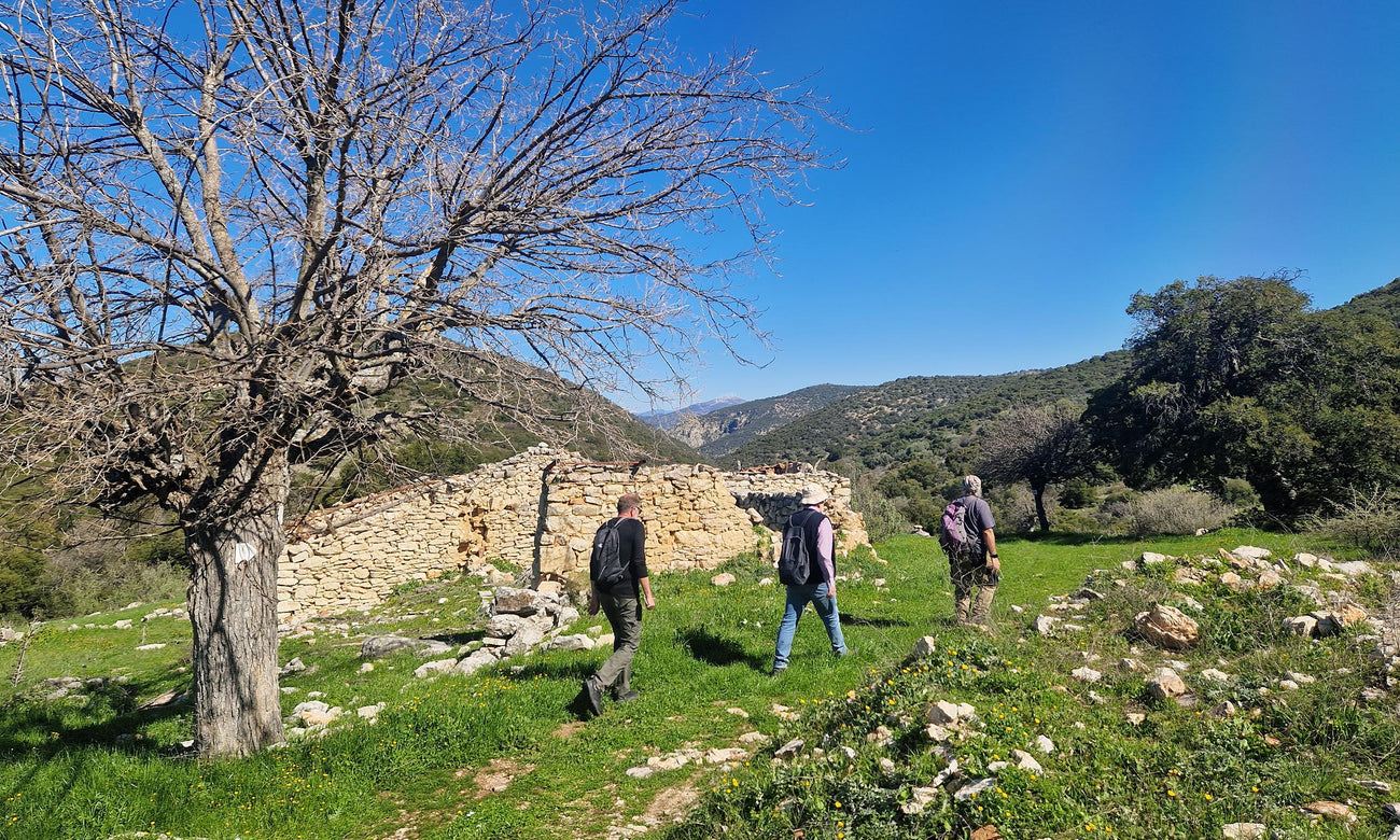
A key strength of this project lies in its participatory mapping approach. Rather than relying solely on mapping professionals, Anavasi mobilized a network of 22 hiking clubs, social cooperatives, and local hikers across the Peloponnese. To support their work, Anavasi provides simplified digital basemaps customized for field use, ideal for marking cleanup zones, identifying signage placement, and coordinating trail work efficiently. These maps are optimized for use in Avenza Maps, enabling local contributors to record and share updates while out on the trail.
This inclusive model allows even non-cartographers to contribute meaningful data, from identifying trail conditions to documenting cultural landmarks. It’s a massive team effort powered by shared knowledge and a strong sense of community.
To ensure everyone gets the most out of these digital tools, Anavasi also offers comprehensive training sessions for local associations. These sessions cover everything from basic map reading to advanced app features, empowering communities to take full ownership of the mapping process. This hands-on involvement fosters deep community engagement and ensures long-term sustainability of the trail networks.
Transforming the Peloponnese into a Hiking Destination
This project is more than a mapping initiative, it's about transforming the Peloponnese into a must-visit hiking destination by showcasing its rich history, beautiful landscapes, and cultural resources. With local experts contributing their deep knowledge of the land, the maps reveal hidden trails and secret gems that might otherwise be overlooked. The hiking clubs, cooperatives, and individual contributors who helped build these maps will also continue to maintain and promote the trails, fostering a culture of care and shared responsibility.
Avenza Maps: The Tech Behind the Trails
We’re proud of the role Avenza Maps has played throughout this process. As a digital mapping solution, Avenza Maps allows users to work offline, collect GPS data in real time, and navigate with precision in even the most remote terrain. The app has been an essential tool for Anavasi’s fieldwork, enabling them to create highly accurate and detailed maps that provide reliable, precise information on the trails.
The Peloponnese Trails project stands as a powerful example of what’s possible when communities, technology, and purpose-driven mapping come together. It offers a replicable model for similar initiatives not just in Greece, but around the world.
The final Peloponnese trail map is still being completed and will be available later this year. In the meantime, you can browse Anavasi’s collection of high-quality Greek hiking maps on Avenza Maps to start planning your adventures. Before you set out to explore the scenic routes of the Peloponnese, be sure to download the latest Anavasi maps for reliable offline navigation, so you can hike with confidence and connect more deeply with the land beneath your feet. Anavasi offers extensive coverage of the region, from northern peaks to southern shores, including detailed hiking maps to guide your journey. Start with these featured maps:
- Peloponnese North
- Peloponnese South
- Taygetos North, Peloponnese Hiking Map
- Taygetos Main, Peloponnese Hiking Map
Looking for more? You can find all Anavasi Editions maps of the Peloponnese here.