Best Autumn Hikes Across the U.S.: A Guide to Stunning Fall Foliage Trails

Best Autumn Hikes Across the U.S.: A Guide to Stunning Fall Foliage Trails

Experience the magic of autumn by exploring some of the best hiking trails across the U.S., where vibrant fall foliage transforms the landscape into a stunning display of red, orange, and gold. From New England’s iconic mountains to the rugged beauty of the Rockies, discover the top trails to immerse yourself in the season’s breathtaking colours and crisp, cool air. Whether you’re looking for a leisurely stroll or a challenging adventure, these scenic hikes offer unforgettable views and an opportunity to fully embrace the beauty of fall.

Scenic Winter Trails in Canada: Snowshoeing and Cross-Country Skiing Adventures

Scenic Winter Trails in Canada: Snowshoeing and Cross-Country Skiing Adventures

Discover Canada's most scenic winter trails for snowshoeing and cross-country skiing. From the rugged alpine views of Garibaldi Provincial Park in British Columbia to the serene, snow-covered forests of Algonquin Provincial Park in Ontario, these trails offer something for adventurers of all levels. Whether you’re gliding through the snow or hiking to panoramic lookouts, immerse yourself in the beauty of Canada’s winter wilderness.

Success Story: Crazy Mountain Ranch

Success Story: Crazy Mountain Ranch

What comes to mind when you think of Montana? Ranches, horseback riding, cattle drives, mountain views, big skies, the wild American West, all of the above? Now imagine a place where you can experience all of that combined with modern amenities like world-class dining, cozy lodging, relaxing spas, epic trails for hiking, biking, and riding, a golf course, and even an authentic Old West town. This is Crazy Mountain Ranch.

Hiking in South Australia’s National Parks

Hiking in South Australia’s National Parks

The Good Men Project featured a list of the most challenging hikes in South Australia’s national parks, perfect for those seeking to push their limits. Trails such as Morialta Conservation Park’s Third Falls Hike and Cleland National Park’s Chambers Gully to Mount Lofty circuit offer breathtaking views alongside steep climbs. Visitors are encouraged to download Avenza Maps to access geo-referenced maps on their smartphones, ensuring they can navigate these tough but rewarding trails with ease.

Portions of New River Trail State Park reopen after Hurricane Helene

Portions of New River Trail State Park reopen after Hurricane Helene

The Patriot recently reported that roughly 25 miles of New River Trail State Park have reopened after significant damage caused by Hurricane Helene. Visitors can now enjoy hiking, biking, and horseback riding along several scenic sections, including parts with access to Chestnut Creek Falls, the Ivanhoe River Bridge, and Foster Falls. Guests are encouraged to download the geo-referenced park map from Avenza Maps to navigate the trail. Although much of the trail is accessible, certain areas remain closed for repairs.

Mountain Biking Trails: Best Maps for Thrilling Rides

Mountain Biking Trails: Best Maps for Thrilling Rides

Mountain biking offers an exhilarating way to connect with nature, test your endurance, and experience the rush of navigating rugged trails. But when it comes to planning your next mountain biking adventure, having the right map can make all the difference. In this guide, we’ll explore some of the most thrilling mountain biking trails and the best maps available on Avenza Maps to help you conquer them!

How to Become a Map Publisher: A Step-by-Step Guide

How to Become a Map Publisher: A Step-by-Step Guide

If you create digital maps and want to reach a broader audience, becoming a map publisher can be a game-changer. At Avenza Maps, we connect you with millions of users worldwide who are eager to discover, purchase, and use digital maps for outdoor adventures, travel, and professional needs. Here’s everything you need to know about becoming a map publisher on the Avenza Map Store.

Exploring Off-the-Grid: Wilderness Adventures Using Avenza Maps

Exploring Off-the-Grid: Wilderness Adventures Using Avenza Maps

For adventurers seeking to escape the beaten path, these five remote wilderness routes offer thrilling, off-the-grid experiences in some of the world’s most untamed landscapes. From paddling through the wild canyons of Canada’s Nahanni River to trekking the rugged Scottish Highlands on the Cape Wrath Trail, each destination provides solitude, breathtaking scenery, and unforgettable encounters with nature.

Red wood canoe on rocky shore of a Boundary Waters lake

Paddling Adventures: Canoeing and Kayaking Routes You Can’t Miss

Discover the top paddling destinations across North America, from the serene lakes of Algonquin Provincial Park to the breathtaking sea caves of Wisconsin’s Apostle Islands. Whether you're navigating Florida's Everglades or exploring the crystal-clear waters of Lake Tahoe, this guide highlights must-see canoeing and kayaking routes.

Virginia State Parks to Host Volunteering Events for National Public Lands Day

Virginia State Parks to Host Volunteering Events for National Public Lands Day

Celebrated on September 28, National Public Lands Day is a special occasion that highlights the importance of public lands and unites volunteers across the country in efforts that foster community and teamwork. Virginia State Parks highlights the use of the Avenza Maps app for National Public Lands Day as there are multiple events happening at parks in Central Virginia. Volunteers participating in trail cleanups at parks like Powhatan State Park are encouraged to download Avenza Maps for easy navigation and access to detailed park trail maps via GPS.

Cycling Routes Through National Parks: A Guide

Cycling Routes Through National Parks: A Guide

Explore the beauty of national parks on two wheels! Whether you're a beginner or an experienced rider, cycling through national parks offers stunning views, peaceful routes, and a chance to connect with nature. From the car-free roads of Acadia National Park to the challenging terrain of Yellowstone, there's something for every cyclist. Enjoy a relaxing ride through Zion’s red rock canyons or take the family on a scenic loop in the Great Smoky Mountains. With plenty of routes to choose from, these parks provide unforgettable cycling adventures.

Challenging Hikes in South Australia’s National Parks

Challenging Hikes in South Australia’s National Parks

In a recent article by Good Living, some of the most challenging hikes in South Australia's national parks were featured, perfect for adventure seekers looking to push their limits. The article highlighted trails such as the Third Falls Hike in Morialta Conservation Park and the Chambers Gully to Mount Lofty trail in Cleland National Park. Hikers are encouraged to download interactive national park maps using the Avenza Maps app, ensuring they can navigate these trails with ease and confidence, even in more remote areas.

Success Story: Discover Jamestown

Success Story: Discover Jamestown

Jamestown, North Dakota, embodies small-town charm with scenic beauty and unique attractions. Warren Abrahamson, Marketing Manager for Jamestown Tourism, is dedicated to promoting the town’s rich history and outdoor trails, alongside its famous world’s largest buffalo. To enhance visitor experiences, Warren introduced digital trail maps through Avenza Maps, allowing easy access via QR codes at trailheads. This modern approach has improved accessibility, offering visitors a seamless way to explore the area. The addition of digital maps has received positive feedback, reinforcing Jamestown as more than just a quick stop, but a growing destination.

Wildfire Suppression in Rural BC fuelled by proactive Water Mapping

Wildfire Suppression in Rural BC fuelled by proactive Water Mapping

In mid-July, nearly 500 wildfires across Canada were ignited by lightning strikes, and Avenza Maps played a critical role in firefighting efforts during the Argenta Creek wildfire in British Columbia. Developed in collaboration between Living Lakes Canada and the Argenta Safety and Preparedness Society (ASAP), maps detailing local water sources, pump deployment sites, and access routes were integrated into the Avenza Maps app. These maps provided crucial, real-time information to BC Wildfire Service crews and local volunteers, enhancing their ability to combat the fire. The resource, praised for its precision, helped streamline the firefighting response and protect the Argenta community.

Launchpad: Surveying & Mapping - Upgraded RTK Rover

Launchpad: Surveying & Mapping - Upgraded RTK Rover

In a recent article by GPS World, the Reach RX RTK rover was highlighted for its new MFi certification, making it compatible with various GIS apps for iOS and Android. The rover provides centimeter-level accuracy and can be used for a wide range of projects, including engineering, landscaping, and utility inspections. Notably, the Reach RX will soon be compatible with Avenza Maps, allowing professionals to seamlessly collect and navigate precise geodata within the app, even in challenging environments.

A Decade on the Water for Paddle Antrim

A Decade on the Water for Paddle Antrim

Paddle Antrim, a nonprofit dedicated to protecting waterways through paddlesports, celebrated its 10-year anniversary. One of their biggest achievements is the creation of the Chain of Lakes Water Trail, a 100-mile waterway with 84 access sites, making it the first state-designated water trail in northern Michigan. To enhance the paddling experience, Paddle Antrim offers a digital map of the trail through Avenza Maps, allowing paddlers to navigate the trail offline without cell service.

Woman exploring the Saklikent Gorge in Turkiye

Top 10 Hidden Hiking Trails Around the World

For those with an adventurous spirit, hidden hiking trails offer a unique way to experience nature away from the crowds. These trails, often lesser-known and off the beaten path, provide unparalleled beauty and solitude. Here are the top 10 hidden hiking trails around the world that promise unforgettable experiences for those who seek them out.

Huckleberry Season on the Gifford Pinchot National Forest

Huckleberry Season on the Gifford Pinchot National Forest

Each August, the Northwest’s berry enthusiasts eagerly anticipate the huckleberry season in Gifford Pinchot National Forest. Forest managers remind the public that a permit is required to harvest berries, whether for personal or commercial use. To make the experience seamless and ensure compliance with forest regulations, collectors can download the Gifford Pinchot NF-Special Products Map via the Avenza Maps app. This map helps users navigate designated areas, ensuring a safe and responsible berry-picking adventure.

Road Trip Planning Tips from Rand McNally

Road Trip Planning Tips from Rand McNally

With 168 years of mapmaking experience under their belts, you can trust Rand McNally state maps to give you the quality and reliability to plan every leg of your road trip. Tom Vitacco, Director of GIS with Rand McNally Publishing and Tristan Lyttle, Senior Product Manager with Avenza Maps have a few tips that will help you effectively plan your next road trip!

Big Sur, California

Exploring Coastal Trails: Beaches, Cliffs, and Sea Views

There’s nothing quite like the combination of fresh sea air, the sound of crashing waves, and breathtaking coastal scenery. Exploring coastal trails offers a unique blend of adventure, tranquility, and natural beauty. Whether you’re an avid hiker or just looking for a peaceful escape, these trails provide some of the most stunning views of beaches, cliffs, and the endless ocean. With our digital maps, you can easily navigate these trails and discover the best spots for an unforgettable coastal experience.

 Sunrise at camping in northern Sweden

Camping Spots with the Best Views

Imagine waking up to the sunrise lighting up tall mountains or falling asleep under a sky full of stars by a calm lake. Camping isn’t just a getaway; it’s a chance to see some of the most beautiful views nature has to offer. Whether you’re an experienced camper or trying it for the first time, these amazing sights can make your trip unforgettable. Join us as we explore the best camping spots with stunning views that you won't want to miss.

Fishing Spots: Where to Find the Best Catch

Fishing Spots: Where to Find the Best Catch

Whether you're a seasoned angler or a novice fisherman, finding the perfect fishing spot is key to a successful and enjoyable outing. With the right digital maps, you can uncover hidden gems and well-known fishing hotspots, ensuring you have the best chance of reeling in a great catch. Here are some great fishing spots to check out, along with maps we suggest to make your fishing experience even better.

Unlock the Secrets of TRCA’s Trails

Unlock the Secrets of TRCA’s Trails

In a recent article, the Toronto and Region Conservation Authority (TRCA) shared insider tips for exploring some of the lesser-known trails in the region. They emphasized the importance of pre-planning adventures by using Avenza Maps' QR codes at trailheads for easy navigation and help explorers stay on track and discover hidden wonders along the way.

 Young woman hiking in the mountains

Top 10 Hiking Trails to Explore This Summer with Avenza Maps

Summer is here, and it's the perfect time to lace up your hiking boots, grab your gear, and hit the trails! Whether you're a seasoned hiker or just starting out, having the right tools can make all the difference in your outdoor adventures. With Avenza Maps, you can ensure a safe, enjoyable, and well-planned hike. Here are our top 10 hiking trails to explore this summer, enhanced by the Avenza Maps app.

Tournée des cantons de Rawdon’s success story

Tournée des cantons de Rawdon’s success story

Founded in 2007, the Tournée des cantons de Rawdon (TDCR for friends and users) is a not-for-profit organization located in Rawdon, Québec. Its mission is to develop and maintain a network of nature trails for non-motorized sports such as cross-country ski, snowshoe, fat bike, mountain bike and hiking. The trails are located in the wooded and hilly lands of the beautiful region of Lanaudière, about 80km North of Montréal. 

Top Summer Biking Trails to Explore Across Canada

Top Summer Biking Trails to Explore Across Canada

There’s no better way to explore Canada than by hitting the trails by bike! From the trails in Lake Louise moving up north towards British Columbia and then back down south to Ontario, there are so many cycling routes to explore. We’ve compiled a list of the best biking trails to hit this summer! Keep reading to learn more about them. 

Bays Mountain Park Introduces New Geo-referenced Trail Map

Bays Mountain Park Introduces New Geo-referenced Trail Map

Bays Mountain Park has unveiled a new geo-referenced trail map covering all 40 miles of trails within the park offering visitors the latest and most precise information. The maps can be downloaded for free and used through the Avenza Maps App.

Person holding a phone that displays Rand Mcnally's Maine map

Rand McNally Road Maps are Going Mobile

Rand McNally is one of the most recognizable names in publishing. They opened their doors in Chicago in 1856, printing train timetables and schedules. Over the next 168 years, they built a reputation for quality and reliability and are today recognized as one of the oldest and most esteemed mapmakers in the world.

From Family Camping to Cross-Country Adventures: Lauren's Journey with Avenza Maps

From Family Camping to Cross-Country Adventures: Lauren's Journey with Avenza Maps

Discover how Lauren, a passionate outdoor adventurer, uses the Avenza Maps App as an indispensable tool for planning and navigating her hikes. This app has greatly enhanced her camping and hiking experiences, enabling her and her family to confidently explore remote areas and assist others on the trail. From dropping pins with notes on trails to accessing a vast collection of offline maps, Avenza Maps has transformed the way Lauren and her family adventure. Her journey with Avenza Maps showcases the power of technology in enriching outdoor activities and inspiring others to embrace nature.

Rand McNally Publishing Announces Historic Partnership with Avenza, Making Trusted Maps Digitally Available for the First Time

Rand McNally Publishing Announces Historic Partnership with Avenza, Making Trusted Maps Digitally Available for the First Time

Rand McNally Publishing, the iconic mapmaker for over 165 years, has announced a groundbreaking partnership with Avenza Maps, bringing their trusted state maps to digital form for the first time. Users can now access Rand McNally's state, regional, and U.S. maps directly from the Avenza Maps website and mobile app. These digital maps maintain the renowned detail and accuracy of Rand McNally, enhanced with features designed for outdoor use.

Top Tips for Visiting National Parks This Winter

Top Tips for Visiting National Parks This Winter

Good Living is your ultimate guide to experiencing the splendour of South Australia's national parks, providing expert insights on exploring nature. Their latest blog offers tips on visiting national parks in winter. One of the most important tips highlighted is to stay on marked trails and that most national parks provide downloadable PDF maps that can be accessed through the Avenza Map app.

How to Run a Scavenger Hunt Using Avenza Maps

How to Run a Scavenger Hunt Using Avenza Maps

We love encouraging you to get outside and enjoy nature! When going somewhere new, what better way to get to know the city or urban park you're exploring than by introducing an outdoor scavenger hunt? We’ve decided to create a scavenger hunt to track down the top landmarks to see in Central Park. This must-visit urban park is a beautiful, sprawling natural space in the heart of New York City. Keep reading to learn more about each of these landmarks!

A Guide to Sharing Maps with the Avenza Maps App

A Guide to Sharing Maps with the Avenza Maps App

Sharing maps with the Avenza Maps App is easier than ever. Whether you've purchased a map from the Map Store or created a custom one, Avenza Maps allows seamless exporting and sharing across devices. You can share Map Store listings through a simple, shareable link, directing users straight to the Map Store. Read more to learn all the ways to share maps using the Avenza Maps App.

USA Bucket List Hiking Trails to Explore This Summer

USA Bucket List Hiking Trails to Explore This Summer

Summer is just around the corner! Break in your hiking boots and hit the trails solo or with friends and family this upcoming season. Whether you’re planning to take a gentle stroll through the woods or embark on an exciting new challenge, hiking is one of the best ways to get outdoors and experience the beauty of nature. We’ve compiled a list of the best trails to hike this summer in the US. Keep reading to find out what they are and some tips to be aware of. 

Avenza Maps 5.3: New Features to Boost Your Mapping Experience

Avenza Maps 5.3: New Features to Boost Your Mapping Experience

Update to Avenza Maps 5.3 today and unlock an array of fantastic new features and improvements. With its enhanced functionality and user-centric design, Avenza Maps is your ultimate companion. Dive into the app and discover how these latest updates elevate your outdoor adventures.

The Avenza User Conference 2024

The Avenza User Conference 2024

Discover the vibrant community and collaboration that defined the Avenza User Conference 2024. Attendees from diverse backgrounds connected to share innovative ideas, strategies, and best practices in mapping and geographic information systems. Did you miss the event, or interested in being a presenter next year? Find out more now!

Paige Conquers Tennessee's 57 State Parks with the Avenza Maps App

Paige Conquers Tennessee's 57 State Parks with the Avenza Maps App

Meet Paige, an avid adventurer from the rolling hills of Tennessee. Discover her journey hiking across all 57 Tennessee State Parks and learn how Avenza Maps transformed her outdoor experience, offering reliable navigation and enhancing her sense of adventure on every unforgettable hike.

Top Spring Adventures for Outdoor Enthusiasts

Top Spring Adventures for Outdoor Enthusiasts

For many of us, spring is a time of renewal and new beginnings. With the weather getting warmer and the days getting longer, it’s the best time to get outside, enjoy nature, and try new adventure activities. Are you seeking inspiration to get out there and make the most of the season? Keep reading, and we’ll drop some locations you won’t want to miss out on. 

Exploring OSM Basemap with the Avenza Maps App

Exploring OSM Basemap with the Avenza Maps App

Discover the power of OSM Basemaps and unleash your outdoor adventures with the Avenza Maps app. Explore trails, navigate terrain, and plan your next journey with ease. Learn how to use OSM Basemaps and the Download Offline Region feature in this article.

Celebrating Saint Patty’s Day!

Celebrating Saint Patty’s Day!

Bring out everything green! Saint Patrick’s Day is celebrated each year on March 17th as a global celebration of Irish culture. It’s a day packed with parades, good luck charms and all things green! Read more in our latest blog post.

Acknowledging International Polar Bear Day

Acknowledging International Polar Bear Day

It’s February 27th, meaning it’s International Polar Bear Day! Every year on this day, International Polar Bear Day aims to raise awareness for the issues that polar bears face. It is a day when we collectively find ways to reduce our carbon footprint to minimize the effects related to global warming. 

Top Snowmobiling Tips for Beginners

Top Snowmobiling Tips for Beginners

Do you long to spend the rest of the winter outdoors, embracing the cold, snowy days rather than staying warm indoors? Snowmobiling is one of the best ways to get outside and make the most of the season. In this blog, we'll share some of the best snowmobiling tips and tricks to be aware of before hitting the trails!

James Vooght's Expedition Through Lenses, Trails, and Avenza Maps

James Vooght's Expedition Through Lenses, Trails, and Avenza Maps

In this blog post, James shares his firsthand experience with the transformative impact of Avenza Maps on his outdoor escapades. The Avenza Maps app has completely reshaped his approach to photography planning, emerging as his primary tool for navigating local terrain. Despite his initial reliance on traditional navigation methods, James now entrusts Avenza Maps for nearly 90% of his planning tasks, effortlessly marking locations and charting trails.

Aerial Detection Survey Quad Maps

Aerial Detection Survey Quad Maps

This blog presents multiple maps resulting from collaborative aerial surveys conducted by Forest Health teams from the Oregon Department of Forestry, Washington Department of Natural Resources, and the USDA Forest Service Pacific Northwest Region. 

Your Top Feature Questions... ANSWERED!

Your Top Feature Questions... ANSWERED!

At the Avenza User Conference 2023, Mike and Chelsea teamed up to tackle various frequently asked questions from Avenza Map users. Covering various topics aimed at improving the app's usability and enhancing the overall user experience, discover more details in this presentation.

Avenza Maps 5.2: Discover Upgraded Features and Refreshed Basemaps

Avenza Maps 5.2: Discover Upgraded Features and Refreshed Basemaps

Embark on enhanced adventures with Avenza Maps 5.2, where fun, safety, and reliability converge. This update introduces a refreshed basemap and incorporates a range of enhanced features to elevate your mapping experience. Download the app today and elevate your mapping experience!

Aerial view of Sydney Harbor and Downtown Skyline, Australia

Top City Tours to Take While Exploring Australia

Are you missing warm, sunny temperatures? Summer in Australia falls between December and February, and this beautiful country is known for its warm weather and hot sunny days. We’ve compiled a list of the top cities to visit in Australia and city tours you can take while travelling here! Curious to find out what they are? Keep reading to find out! 

Avenza – Never Get Lost Again

Avenza – Never Get Lost Again

In The Ultralight Hiker's recent exploration of the Avenza Maps app, a noteworthy transformation in the mapping tool came to light. On revisiting Avenza, they were impressed by its extensive array of free maps, particularly focusing on Victoria. The app's swift location detection and continuous tracking during a walk left a lasting impact.

Avenza Digital Maps

Avenza Digital Maps

Discover the limitless potential of river navigation with RiverMaps Digital – your gateway to unmatched exploration. Convenient QR codes and download links are provided for seamless access through the Avenza store.

Top 5 Magical Sleigh Rides Around the World

Top 5 Magical Sleigh Rides Around the World

Winter is one of the most magical times for a sleigh ride, especially as we get immersed in the Christmas spirit and find fun activities in the snow! From jingle bells to Christmas carols and many Christmas markets to visit, there is nothing short to celebrate this festive season. Check out where you can experience the best winter sleigh rides this holiday!


Publishing a Digital Recreational Map for the Avenza Maps App

Publishing a Digital Recreational Map for the Avenza Maps App

During the Avenza User Conference 2023, Bridger explained the process of publishing a digital recreational map, with the focal point of his discourse revolving around the seamless integration of the Avenza Maps App as the conduit for this digital cartographic journey.

Largest Canadian Winter Festivals 2024

Largest Canadian Winter Festivals 2024

Winter is just around the corner, and what better way to celebrate the season than by checking out the best winter festivals? Whether you love the winter or want to escape the cold, these top cozy winter festivals will help do the trick! We’ve compiled a list of the largest Canadian Winter Festivals to add to your list in 2024. Check them out here!

Importing Multi-Page PDFs with Avenza Maps App

Importing Multi-Page PDFs with Avenza Maps App

Learn how to import multi-page PDFs in Avenza Maps. If you're a new visitor, the details provided below will assist you in understanding and putting to use the features of importing Multi-Page PDFs with Avenza Maps, and if you're already a pro user, here's a quick refresher.

Best Pumpkin Patches to Visit in the US this Fall

Best Pumpkin Patches to Visit in the US this Fall

What could be better than the crisp, cool air, beautifully coloured leaves surrounding you, sweater weather, and pumpkin patches? We’ve compiled a list of the best pumpkin patches to visit around the US this season. Get ready and save these locations to soak up the rest of the season this month!

Showcasing the New Avenza Map Store

Showcasing the New Avenza Map Store

During the Avenza User Conference 2023, Rebecca goes over how the Map Store search works, new and improved features, tools and search functionalities. Through this video one can understand the ins and outs of the Map Store and how it benefits both users and publishers.

Exploring How Conservation Groups Use Avenza Maps!

Exploring How Conservation Groups Use Avenza Maps!

Globally, parks and protected areas aim to protect wildlife and nature, allowing visitors to learn more about and enjoy the beautiful outdoors! Many organizations seek ways to understand and utilize data to make more informed decisions. With Avenza Maps, conservation teams worldwide can record data, track notes, and attach geo-tagged photos directly on their downloadable offline maps.


Best surveying apps for iPhone and iPad

Best surveying apps for iPhone and iPad

In this article, we will thoroughly explore the best surveying apps available on the Apple platform. Avenza Maps has been designed for those looking for National Geographic maps, national parks and more for their work or adventures.

Unity-based land trust to offer October programs

Unity-based land trust to offer October programs

Sebasticook Regional Land Trust is set to continue its series of 2023 programs with a meditative, nature exploration walk at Pleasant Lake Preserve in Stetson, a workshop to learn the Avenza Maps app, and a trail work day at Moulton’s Mill Preserve in Unity.

58 female rangers finish leadership skills course

58 female rangers finish leadership skills course

On April 5th, 58 female rangers from environmental departments spanning over 14 provinces successfully concluded a comprehensive three day course centered on gender equality leadership in natural resource management in Kampong Thom province. The course included training in Avenza Maps, GPS, drones, similar geographic information tools. 

Mohave County officials find missing hikers

Mohave County officials find missing hikers

Mohave County officials rescued two women from Cerbat Foothills Recreation Area after they recieved a call that two women were lost and needed help out if the trails. There is a map at the trailhead with instructions on how to download Avenza Maps to keep you safe and on the trail at all times!

Unity land trust lists September programs

Unity land trust lists September programs

The Sebasticook Regional Land Trust is scheduled to offer three programs this month, one of them being an Avenza Maps Training program. Find out more about the training program here.

Use GIS for girdawari, Punjab officials told

Use GIS for girdawari, Punjab officials told

The Revenue Department asked district officers at various farm unions to use GIS ( Geographic Information System) based technology to watch their crops, and have been using Avenza Maps since.

Unveiling the Digital Age of Gold Prospecting with Doug Stone Gold Maps

Unveiling the Digital Age of Gold Prospecting with Doug Stone Gold Maps

Doug Stone Gold Maps is a passionate endeavour rooted in preserving gold prospecting history while embracing modern technology. Their collaboration with Avenza Maps blends tradition with innovation, creating maps that not only guide but also ignite the spirit of exploration and adventure in every prospector.

5 of the Best Hunting Destinations in Canada

5 of the Best Hunting Destinations in Canada

It’s no secret that Canada is so well known for its fantastic hunting opportunities. You can spot unique wildlife throughout the country, as the possibilities for an animal-related adventure are endless. We've put together a list of Canada's five best hunting destinations to check out this fall.

Avenza Maps 5.1: Enhanced Features and Upgrades

Avenza Maps 5.1: Enhanced Features and Upgrades

To make our users' experience better, we are announcing the release of Avenza Maps 5.1. This update brings a few new features and important improvements for everyone to enjoy. Learn more about the latest features and upgrades to enhance your experience with Avenza Maps. Download the app today!

Introducing the #BlueDotScreenshot: Share Your Experience!

Introducing the #BlueDotScreenshot: Share Your Experience!

When travelling somewhere new, whether a new city country, or simply exploring a new hiking trail, one of our first instincts is to grab a photo! How could it not be? By capturing a photo of your experience, you can relive that experience later on and tell stories you wouldn’t otherwise be able to tell quite the same way. With this in mind, we decided to introduce the #BlueDotScreenshot!

How to Manage Symbol Sets in the Avenza Maps App

How to Manage Symbol Sets in the Avenza Maps App

Learn how to use and manage symbol sets in Avenza Maps. If you're a new visitor, the details provided below will assist you in understanding and putting to use the features of managing symbol sets with Avenza Maps, and if you're already a pro user, here's a quick refresher.

Best Cycling Destinations in Europe

Best Cycling Destinations in Europe

As we near the end of summer and soon invite autumn along the horizon, there’s no better time to start planning which cycling routes we’ll explore next season. We’ve created a list of Europe's five best cycling destinations to explore! Ready to explore beyond the norm and discover new horizons? Keep reading to learn more and download cycling maps for each new destination!

Avenza UC Speaker - Paul Edwards and Rebecca Bennett

Your Top 5 Avenza Maps Questions... ANSWERED!

During the Avenza User Conference 2023, Rebecca and Paul collaborated to address a series of commonly posed inquiries from Avenza Map users. These frequently asked questions encompass a diverse array of subjects aimed at enhancing the app's usability and overall user experience. Find out more in this presentation.

Exploring the Power of Nature with Deborah Padilla

Exploring the Power of Nature with Deborah Padilla


Have you ever considered the mental health benefits of hiking? This month, we had the pleasure of speaking with Deborah Padilla, a therapist, author, and host of the podcast Hiking Is My TherapyGet ready to be inspired and informed as we dive deep into Deborah's fascinating story, where she opens up candidly about her journey with the Avenza Maps app.

Avenza Maps 5.0: Exciting New Release of New & Improved Features

Avenza Maps 5.0: Exciting New Release of New & Improved Features

As part of our continued efforts to improve the experience of all our users, we are pleased to announce the release of Avenza Maps 5.0! This is one of the largest releases with exciting new features and updates. We are excited for you to experience and enjoy the new and improved Avenza Maps App. Download it today!

Acknowledging World Population Day

Acknowledging World Population Day

Every year, we observe World Population Day on July 11th, which seeks to raise awareness of global population issues. The United Nations established this day as a response to a growing interest in Five Billion Day in 1987. As you can deduce from the name, Five Billion Day was the date that the world surpassed a population of five billion people. Now, we are at a population of 8 billion people!

AvenzaUC Speakers Hamza Salman and Tristan Lyttle

What’s New in Avenza Maps

At the Avenza User Conference 2023, Tristan and Hamza took center stage to showcase the latest updates and enhanced features of Avenza Maps. The Avenza User Conference is a free virtual conference for map makers, GIS enthusiasts, and geospatial professionals. Find out What’s new in Avenza Maps in this presentation.

5 Best Waterfall Hikes to Discover with Avenza Maps

5 Best Waterfall Hikes to Discover with Avenza Maps

In case you couldn’t guess, hiking is one of our all-time favourite outdoor activities! Although we love hiking year-round, the summer offers the greatest opportunities for checking out the best waterfall hikes. What’s better than taking in the beauty around you while on the trail? Being rewarded with a stunning view of a waterfall! We’ve compiled a list of the best hiking trails with waterfalls for you to discover! 

Avenza Maps App Record GPS Track

Explore the Record GPS Track tool in the Avenza Maps App

Avenza Maps has revolutionized the way we experience the great outdoors, infusing it with excitement and fulfillment through its remarkable feature: Record GPS Tracks. By leveraging this app, users can effortlessly track, record, and share their awe-inspiring journeys and significant milestones. Explore the Record GPS function to track and record your adventures, adding a touch of wholesomeness to your summer adventures.

Toronto and Region Conservation Authority Success Story

Toronto and Region Conservation Authority Success Story

Toronto, Ontario, is where Avenza Systems calls home. Even though it is one of the densest and most populous cities in the country, there is ample green space for outdoor enthusiasts like us to explore. Toronto and Region Conservation Authority (TRCA) plays a pivotal role in conserving this greenspace, so it was only natural that we work together to help everyone enjoy the beauty the Greater Toronto Area (GTA) has to offer.

World Reef Awareness Day

World Reef Awareness Day

It’s June 1st! Not only is it the unofficial announcement of summer, but we celebrate World Reef Day! World Reef Day is a day when the world comes together in awareness to reflect on our earth’s delicate coral reefs and take action to prevent further reef loss.

AvenzaUC 2023 Speaker Steve Lauterbach

Avenza Maps is Invaluable on the Arnold Rim Trail - Steve Lauterbach

Steve Lauterbach is the Chairperson at Arnold Rim Trail Association and was one of our esteemed speakers at the Avenza User Conference 2023. The Avenza User Conference is a free virtual conference for map makers, GIS enthusiasts, and geospatial professionals. In his presentation, Steve outlines how collaborating with Avenza Maps has benefited ARTA.

Top 6 Flower Festivals to Visit this Season

Top 6 Flower Festivals to Visit this Season

The love of flowers and plants is worldwide! There’s a reason May is known as the season of flowers, it’s that beautiful time of year when the weather starts to get warmer, and everything is in full bloom. To make the most of the flower season, we’ve compiled a list of the top 6 flower festivals in May happening worldwide!

Brian exploring the NJ trails with Avenza Maps

Exploring The NY-NJ Trail with The Avenza Maps App

Brian Shultis, a passionate hiker from New Jersey, explores the NY-NJ Trail using the Avenza Maps App. The app’s features piqued his interest to explore the trail more. The option to customize map layers inspired him to go out and enjoy challenging adventures. Learn how Avenza Maps played a vital role in Brian’s outdoor adventures.

Avenza Participates in Clean Toronto Together

Avenza Participates in Clean Toronto Together

On April 21st, Avenza participated in Clean Toronto Together to celebrate Earth Day! Since 2004, the city of Toronto has held a city-wide spring cleanup bringing Toronto residents, schools, community groups and businesses together to restore green spaces within the city. If you cannot attend a community cleanup event, we encourage you to clean up your local park or green area this week!

The Historic Journey Through Sweden with Historiska GIS-kartor

The Historic Journey Through Sweden with Historiska GIS-kartor

Do you ever wonder what local history is around you? Did you watch Indiana Jones with dreams of becoming an archaeologist? Learning what artifacts and buildings existed in our towns long before us can be fascinating. Luckily, the Map Store is home to a great selection of historical maps. This month we talked to Historiska GIS-kartor to learn more about historical maps of Sweden.

Father and son catching fish from a boat at sunset

5 Best Fishing Spots to Explore this Spring

Is there anything more invigorating than spending the spring by the water? After a few long gloomy months, we are finally on the other side and ready to welcome warmer weather! Whether you’re fishing, surfing, or boating this spring and summer, warm weather and water sound like a match made in heaven!

Hike the Peaks and Valleys with Elevation Changes Cartographic

Hike the Peaks and Valleys with Elevation Changes Cartographic

Have you ever heard the saying ‘West coast best coast’ in North America? I’m sure many people would agree. How can you not love the lush forests, towering fir trees and the vast expanse of mountains? For this month's featured publisher, we are visiting the best coast and talking to Elevation Changes Cartographic LLC, created by James Wilson.

Person looking at the Map Layers option on a smartphone

How to Manage Map Layers in Avenza Maps

Avenza Maps has made managing map layers simple and hassle-free for our iOS and Android users. If you're a new visitor, the details provided will assist you in understanding and putting to use the features of managing map layers with Avenza Maps, and if you're already a pro user, here's a quick refresher.

Celebrating St Patrick’s With Avenza Maps

Celebrating St Patrick’s With Avenza Maps

Bring out everything green! Saint Patrick’s Day, celebrated each year on March 17th, is a global celebration of Irish culture. All around the world, you will find packed parades, good luck charms, special foods, parties and green all around!

A Geographical Slice of Pi - How To Celebrate Pi Day 2023

A Geographical Slice of Pi - How To Celebrate Pi Day 2023

Every year, March 14th is recognized as one of the most famous days around the world by mathematicians, scientists, and math lovers alike: it’s Pi Day! Although we’re not celebrating actual pies on this day, there can most definitely be pies involved in your celebration.

Jack and Jude's Banyandah on a voyage

How Jack and Jude Use Avenza Maps

Jack and Jude shared with Avenza Maps their stories and adventures. They use Avenza Maps for all their expeditions and thanks to Avenza Maps they were able to clear and track the historical Gould's Track. Avenza Maps has become an essential part of Jack and Jude's adventures as they are able to achieve so much more and faster by using Avenza Maps App on their iPad.

Ski in winter season, mountains and ski touring equipments on the top in sunny day

The Best Ski Resorts in Canada Worth a Visit

As we’re well into the depths of winter, it’s the perfect time of year to get your winter gear for your next outdoor adventure! Even though winter started a few months ago, it wasn’t until now that you could really start to hit the slopes and enjoy winter for all that it has to offer!

View of mountains and blue sky

Top Hiking Trails to Explore in Australia Using Avenza Maps

Australia is the land of exhilarating road trips, modern cities, the world’s friendliest people, and gorgeous beaches! But this isn’t all this beautiful country has to offer. Immerse yourself in nature as you explore the best hiking trails around Australia.

How to Add a Placemark in Avenza Maps

How to Add a Placemark in Avenza Maps

Have you ever visited a place and just thought, I need to mark this place down right now before I forget? Perhaps you explored a new hiking trail that you can’t wait to visit again, or you set up camp in a remote spot you’ve never heard of.  With Avenza Maps, you can simply add a placemark on any map to remember your location for next time! 

Christmas Market in Winter

Best Christmas Markets Around the World

All around the world, people celebrate Christmas in beautiful and unique ways. There are endless Christmas markets to explore this holiday season, and we’ve curated a list of the BEST ones to visit! 

A Mariah Carey Christmas

A Mariah Carey Christmas

When is the official start of Christmas? That question has been on everyone’s head for decades, if not more. Using Spotify data from last year, 2021, we have researched when and where Mariah Carey’s song gets into the top 10 on each country and, if so, when it hits #1.

Calero Map

Santa Clara County Parks Success Story

One of the goals of Santa Clara County Parks is “to provide access to outstanding recreational opportunities, a rich cultural-historical legacy, and an expansive regional trail system for all to enjoy.” Avenza Maps is proud to have been selected as a tool to help the County accomplish this goal. Over 52,000 acres of land are covered by 29 parks whose maps are now accessible through Avenza Maps QR codes posted on trailheads and in trail centers.

Arnold Rim Trail Success Story

Arnold Rim Trail Success Story

The Arnold Rim Trail, located in Arnold, California, meanders through the Sierra Nevada Mountains in Stanislaus National Forest. Featuring panoramic vistas, sweeping old-growth forests, and diving canyon paths, it is no wonder why this trail is popular for hiking, mountain biking, and horseback riding. The Arnold Rim Trail Association (ARTA) and its all-volunteer crew are the caretakers of this local gem. We spoke with Lauren Scott, a longtime ARTA member, about how they have been using Avenza Maps for years and what their recent deployment of Avenza Maps QR Codes has done for their organization and their visitors.

Taking Mapping to New Heights

Taking Mapping to New Heights

Have you ever dreamed of hiking Everest? Tackling the famous summit and making your mark as one of the small numbers of people to do so? Or even a small hike in the Himalayas? This month, we spoke to Partha S Banjeree of WNL-Newscript/Milestone Books, who makes maps of the Everest and other Himalayan regions.

Exploring the Andes with Andeshandbook

Exploring the Andes with Andeshandbook

The Andes mountain range is the longest continental mountain range in the world. Learn all about the famous hiking region and mapping the Andes with Andeshandbook!

Mapping Alaska with BarnwellGeospatial

Mapping Alaska with BarnwellGeospatial

BarnwellGeospatial, owned and created by Charles Barnwell seeks to make the highest quality, and up-to-date topographic maps available, with a focus on America’s 49th state, Alaska!

Walking the Italian Alps with Fraternali Editore

Walking the Italian Alps with Fraternali Editore

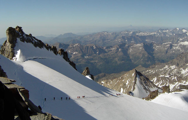
This month’s Publisher Feature is all about Fraternali Editore from Italy. Walking over 50,000km to get the most accurate data for their maps, they put their heart, soul, and walking shoes into what they do! To learn more about Fraternali Editore, we spoke to Mario Fraternali, one of the owners of the company.

Australian Landscape with Signal Prospecting logo

Gold Prospecting Maps Strike Gold

Everyone loves a treasure hunt, and who doesn’t love gold? The newest gold maps in the Avenza Map Store are from Signal Prospecting, owned and operated by Glenn Holbrook. While Glenn loves snow sports, surfing, and skating, he admits he’s kind of obsessed with finding gold.

Quinte conservation entrance

New Ways to Explore Quinte Conservation Authority

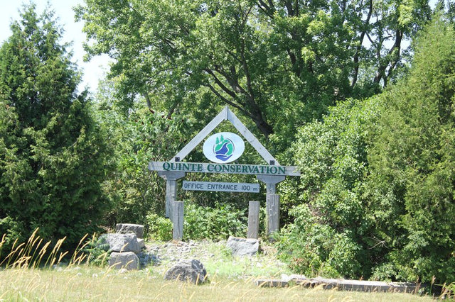
Looking for some of the best trails in Southeastern Ontario? Look no further than Quinte Conservation Authority (QCA). One of the newest publishers in the Avenza Map Store, Quinte Conservation Authority owns over 30,000 acres of land, which include managed forests, nature reserves, and 11 different conservation areas with trails to explore.

Beach view

The Best Maps to Enjoy Australian Beaches

While the North Hemisphere survives the Winter, freezing temperatures and snowstorms, there is still an island in Oceania living upside down. Australia is the sixth biggest country in the world by landmass, home of the Sydney Opera House, the Great Barrier Reef and some of the most beautiful beaches on the planet.

Person snowmobiling through a snowy forest

United States Snowmobile routes to enjoy this Winter

Winter is here. The season that promises snowball fights, Christmas dinners and lots of Mariah Carey music on the radio has finally arrived. And while some people might be locked at home waiting for the warm weather to come back and rescue us from the long nights, you are different. You are the kind of person who is always looking for something to do, an adventure, a challenge. Lucky for you, we have a few!

Group of cyclers

Off The Map with offthemaps!

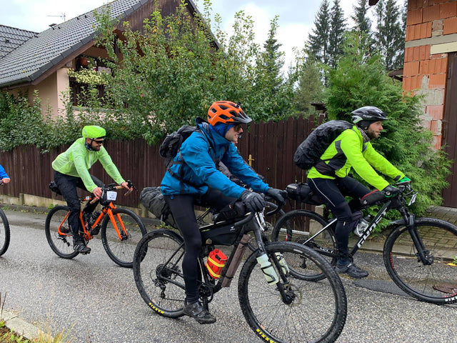
Patrick Stephens is the creator of offthemaps, a mapping company that focuses on outdoor recreation maps, hiking maps, and cycling maps. Read his full feature here!

5 Must Hike Trails at Great Smoky Mountains National Park

5 Must Hike Trails at Great Smoky Mountains National Park

For those of you who are unfamiliar with the Great Smoky Mountains National Park, you'll certainly want to know the best hiking trails to make the most of the Smokies. We’ve curated a list of our personal favourite trails to give you a taste of the surreal beauty of Great Smoky Mountains National Park.

Get New Map Versions Into the Hands of Buyers

Get New Map Versions Into the Hands of Buyers

With nearly 1 million maps available in the Avenza Map Store, offering new map version can help set your listing apart. Map Versions allows you to update your map products and automatically notify users about the new version.

Featured Map Store Publisher - Geopsis

Featured Map Store Publisher - Geopsis

Mountain mapping is a laborious process that GEOPSIS has managed to master. The team uses drones and other unique methods to make cartography easy to read and understand.

Featured Publisher - Bikeverywhere

Featured Publisher - Bikeverywhere

Doug Shidell is a biking enthusiast and author turned cartographer who has made the Avenza Map Store part of his distribution network since its early days.

Featured Publisher - MapSherpa

Featured Publisher - MapSherpa

MapSherpa are experts in digital mapping and were one of the pioneers in delivering maps to consumers via the web. They continue to innovate by adding digital map sales through the Avenza Map Store to their repertoire.