Digital map for use exclusively in the Avenza Maps app
Bundle
3
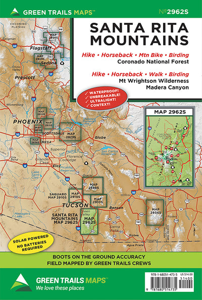
2962S: Santa Rita Mountains, AZ
- Cycling
- Hiking
- Horseback Riding
$14.99 USD
With a relief of more than 7,000 feet and a distinct pyramidal shape, Mount Wrightson in the Santa Rita Mountains is a prominent landmark in southern Arizona. At 9,453-feet, it is the highest mountain in the Tucson Area. A network of trails traverse its rocky, chaparral, and forested slopes and l...
Geographic area:
Category:
Parks & Forests
Size:
29.3MB
Publication:
2018
Language:
English
This product is available exclusively in digital format, for use only in the Avenza Maps app.
Map bounds
Maps included in this bundle
This bundle contains 3 maps


What you get with Avenza Maps

Reliable mapping tools
Record GPS tracks, add placemarks, add photos, measure distances, and much more.

Locate yourself with GPS
Avenza Maps offline GPS app on your mobile device can locate you on any map, without WiFi or network connectivity.

The best maps by the best publishers
Download professionally curated digital maps on the Avenza Map Store from the best-renowned publishers.