

Digital map for use exclusively in the Avenza Maps app
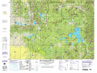
Ashton, 1990, 2nd edition of JOG Air NL-12-11 at 250000 scale
$9.99 USD
Ashton, Idaho (and parts of Montana, and Wyoming), United States is the clearest topo map published at this scale, with layer coloring, relief shading, and contours. It is part of the Joint Operations Graphic (JOG) / 1501 Air series, published by the U.S. government.
Reprojected in 2020 by Wha...
Reprojected in 2020 by Wha...
Geographic area:
Category:
Topographic
Size:
42.77MB
Publication:
August 1990
Language:
English
This product is available exclusively in digital format, for use only in the Avenza Maps app.
Map bounds
Check nearby mapsWhat you get with Avenza Maps

Reliable mapping tools
Record GPS tracks, add placemarks, add photos, measure distances, and much more.

Locate yourself with GPS
Avenza Maps offline GPS app on your mobile device can locate you on any map, without WiFi or network connectivity.

The best maps by the best publishers
Download professionally curated digital maps on the Avenza Map Store from the best-renowned publishers.