11
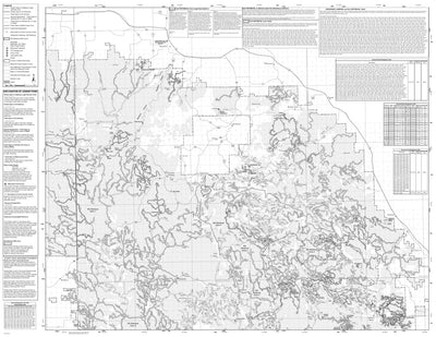
Black Hills NF - Northern Hills Ranger District - MVUM
US Forest Service R2 Rocky Mountain Region
- Backroading
- Forestry
- Off-roading
- Orienteering
This product can also be purchased as part of the following bundle(s).
Free
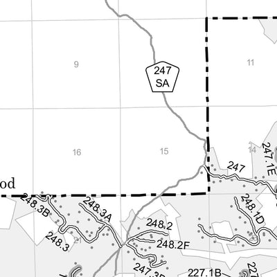
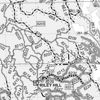
Motor Vehicle Use Maps (MVUM) are the official maps for designating all roads and trails available for public motorized travel on National Forests & Grasslands. Visitors should not rely on any other maps for making decisions about motorized travel.
The MVUMs are free to the public at local...
The MVUMs are free to the public at local...
Geographic area:
Category:
Parks & Forests
Size:
16.43MB
Publication:
January 2024
Language:
English
Map bounds
Check nearby maps Customer Reviews
4.9 Based on 11 Reviews
Customer Photos
- Reviews
- Questions
Filter Reviews:
- camp
- Hill City Ranger
- expertise
- office
- trail rides
- movements
- Avenza maps
- phone
- directions
- others
A
07/24/2024
Anonymous
I recommend this product
Worked great
Map worked well when out of cell range and was fairly accurate
A
07/23/2024
Anonymous
I recommend this product
Trail map
Very good worked like a charm
A
07/16/2024
Anonymous
I recommend this product
Great Experience
I used this map and the expertise of the Hill City Ranger office and was able to locate a fantastic dispersed camp.
What you get with Avenza Maps

Reliable mapping tools
Record GPS tracks, add placemarks, add photos, measure distances, and much more.

Locate yourself with GPS
Avenza Maps offline GPS app on your mobile device can locate you on any map, without WiFi or network connectivity.

The best maps by the best publishers
Download professionally curated digital maps on the Avenza Map Store from the best-renowned publishers.