Digital map for use exclusively in the Avenza Maps app
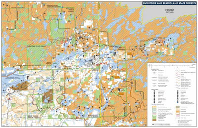
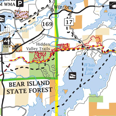
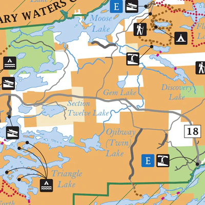
Burntside and Bear Island State Forests
Minnesota Department of Natural Resources
- Camping
- Fishing
- Hunting
- Paddling
Free
Burntside and Bear Island State Forests GeoPDF Map from MNDNR
hunting
hiking
fishing
cross-counrty skiing
berry-picking
canoeing
camping
cross-country skiing
off-highway vehicle riding
snowmobiling
This is a public recreation map of Burntside State Forest and Bear Island State Forest. Burntside...
hunting
hiking
fishing
cross-counrty skiing
berry-picking
canoeing
camping
cross-country skiing
off-highway vehicle riding
snowmobiling
This is a public recreation map of Burntside State Forest and Bear Island State Forest. Burntside...
Geographic area:
Category:
Hunting & Fishing
Size:
10.57MB
Publication:
July 2019
Language:
English
This product is available exclusively in digital format, for use only in the Avenza Maps app.
Map bounds
Check nearby mapsWhat you get with Avenza Maps

Reliable mapping tools
Record GPS tracks, add placemarks, add photos, measure distances, and much more.

Locate yourself with GPS
Avenza Maps offline GPS app on your mobile device can locate you on any map, without WiFi or network connectivity.

The best maps by the best publishers
Download professionally curated digital maps on the Avenza Map Store from the best-renowned publishers.