
Digital map for use exclusively in the Avenza Maps app
1
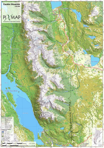
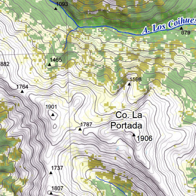
Cordón Situación - Los Alerces national park 1/50.000
- Camping
- Fishing
- Hiking
- Skiing
$9.99 USD
Cordón Situación in Los Alerces National Park.
Scale/Escala: 1/50.000
Contours/Equidistancia: 25 meters/metros
Grids/Grillas: UTM19 Sur and Lat/Long Coordinates, Datum WGS84
Size/tamaño: 60*42cm.
www.pixmap.org
Scale/Escala: 1/50.000
Contours/Equidistancia: 25 meters/metros
Grids/Grillas: UTM19 Sur and Lat/Long Coordinates, Datum WGS84
Size/tamaño: 60*42cm.
www.pixmap.org
Geographic area:
Category:
Topographic
Size:
27.8MB
Publication:
2022
Language:
English, Spanish
This product is available exclusively in digital format, for use only in the Avenza Maps app.
Map bounds
Check nearby maps Customer Reviews
5.0 Based on 1 Reviews
Write a Review Ask a Question - Reviews
- Questions
Filter Reviews:
- referencias
- todo
- parte
A
08/29/2022
Anonymous
I recommend this product
Excelente mapa
Esta perfectamente georeferenciado y todo coincide bien. Muy recomendable para esta parte del Parque Nacional Los Alerces de la cual hay muy pocas referencias.
What you get with Avenza Maps

Reliable mapping tools
Record GPS tracks, add placemarks, add photos, measure distances, and much more.

Locate yourself with GPS
Avenza Maps offline GPS app on your mobile device can locate you on any map, without WiFi or network connectivity.

The best maps by the best publishers
Download professionally curated digital maps on the Avenza Map Store from the best-renowned publishers.