Digital map for use exclusively in the Avenza Maps app
1
Independence Pass, CO FSTopo Legacy
Free
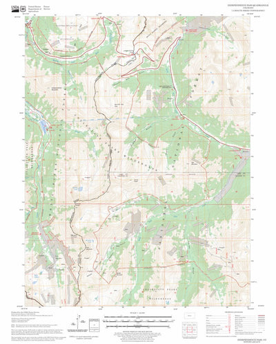
This is a map of Independence Pass, CO and is part of the FSTopo Legacy set. FSTopo Legacy is a static and historic collection of topographic maps produced by the Forest Service. The set is no longer maintained but can be obtained from https://data.fs.usda.gov/geodata/rastergateway/states-regions...
Geographic area:
Category:
Topographic
Size:
14.84MB
Publication:
2023
Language:
English
This product is available exclusively in digital format, for use only in the Avenza Maps app.
Map bounds
Check nearby maps Customer Reviews
5.0 Based on 1 Reviews
Customer Photos

- Reviews
- Questions
Filter Reviews:
H
07/14/2024
hort
I recommend this product
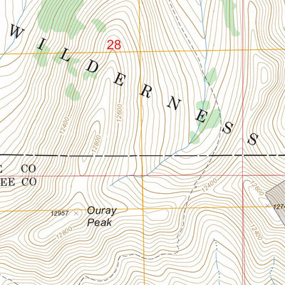
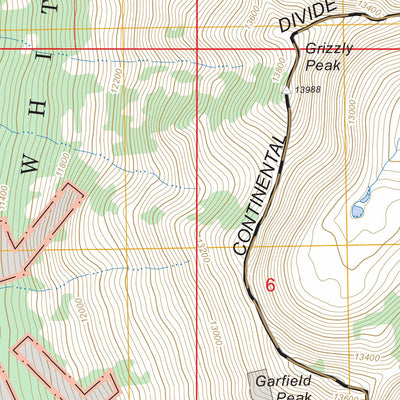
Grizzly Peak
Provided support fir Grizzly apesk scramble

What you get with Avenza Maps

Reliable mapping tools
Record GPS tracks, add placemarks, add photos, measure distances, and much more.

Locate yourself with GPS
Avenza Maps offline GPS app on your mobile device can locate you on any map, without WiFi or network connectivity.

The best maps by the best publishers
Download professionally curated digital maps on the Avenza Map Store from the best-renowned publishers.