

Digital map for use exclusively in the Avenza Maps app
Indi River - Whitewater Kayaking Map
- Paddling
Free
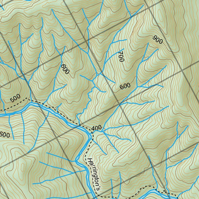
The Indi is a long wilderness whitewater trip through medium volume continuous rapids in the unregulated reaches of Australia’s longest river.
This map has rapid locations and grades with details to plan a trip.
This map has rapid locations and grades with details to plan a trip.
Geographic area:
Category:
Parks & Forests
Size:
19.05MB
Publication:
January 2025
Language:
English
This product is available exclusively in digital format, for use only in the Avenza Maps app.
Map bounds
Check nearby mapsWhat you get with Avenza Maps

Reliable mapping tools
Record GPS tracks, add placemarks, add photos, measure distances, and much more.

Locate yourself with GPS
Avenza Maps offline GPS app on your mobile device can locate you on any map, without WiFi or network connectivity.

The best maps by the best publishers
Download professionally curated digital maps on the Avenza Map Store from the best-renowned publishers.