

Digital map for use exclusively in the Avenza Maps app
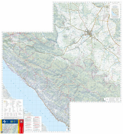
Južni Velebit / South Velebit
Croatian Mountain Rescue Service - HGSS
- Cycling
- Forestry
- Hiking
$4.99 USD
Velebit Masiff is the longest (145 km) and fourth highest mountain in Croatia but it stands out and dominates the entire area, dividing it into seaside and landside.
Južni Velebit (South Velebit), or to be more accurate, South Velebit area depicted on this chart stretches for about 26 kilomete...
Južni Velebit (South Velebit), or to be more accurate, South Velebit area depicted on this chart stretches for about 26 kilomete...
Geographic area:
Category:
Parks & Forests
Size:
104.76MB
Publication:
2023
Language:
Croatian, English
This product is available exclusively in digital format, for use only in the Avenza Maps app.
Map bounds
Check nearby mapsWhat you get with Avenza Maps

Reliable mapping tools
Record GPS tracks, add placemarks, add photos, measure distances, and much more.

Locate yourself with GPS
Avenza Maps offline GPS app on your mobile device can locate you on any map, without WiFi or network connectivity.

The best maps by the best publishers
Download professionally curated digital maps on the Avenza Map Store from the best-renowned publishers.