
Digital map for use exclusively in the Avenza Maps app
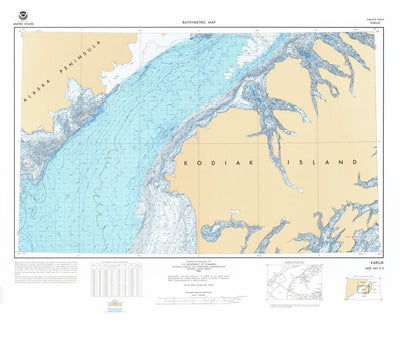
Karluk (NO 5-5)
National Oceanographic & Atmospheric Administration (NOAA)
Free
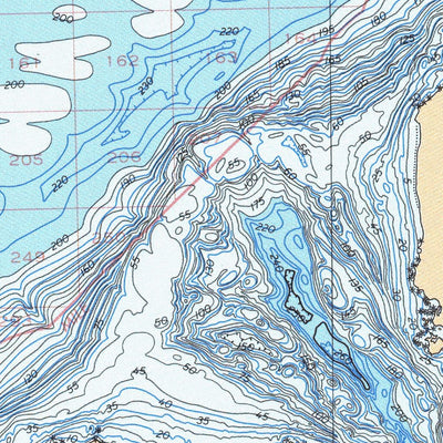
Karluk (NO 5-5) is a topographic map of the sea floor created in 1:250,000 scale, in 1987. Detailed depth contours provide the size, shape and distribution of underwater features. The map serves as a tool for performing scientific, engineering, marine geophysical and environmental studies, that a...
Geographic area:
Category:
Nautical
Size:
45.0MB
Publication:
1983
Language:
English
This product is available exclusively in digital format, for use only in the Avenza Maps app.
Map bounds
Check nearby mapsWhat you get with Avenza Maps

Reliable mapping tools
Record GPS tracks, add placemarks, add photos, measure distances, and much more.

Locate yourself with GPS
Avenza Maps offline GPS app on your mobile device can locate you on any map, without WiFi or network connectivity.

The best maps by the best publishers
Download professionally curated digital maps on the Avenza Map Store from the best-renowned publishers.