Digital map for use exclusively in the Avenza Maps app
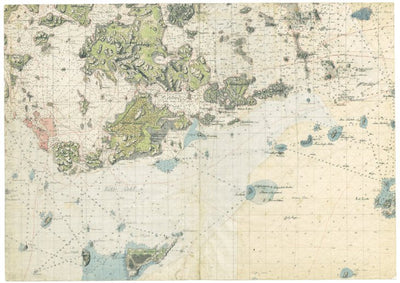
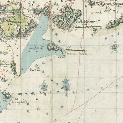
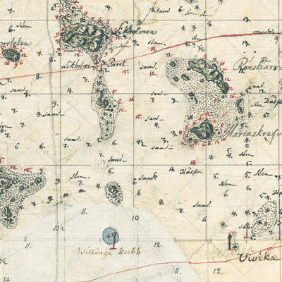
Kuninkaallinen merikartasto 1790-luku: Santahamina. Royal maritime chart of 1790s: Santahamina
Free
Santahaminan karttalehti XVI-19 1:20 000, Kuninkaallinen merikartasto 1791-1796, C. N. Klerckerin kartoitustyö, lehden koko 70 cm x 50 cm, ruotsinkielinen, käsinvärjätty, sisältää matalan vedenalueet, karikot, laivaväylät ja syvyyslukuja
A detailed topographic and nautical map of Helsinki sker...
A detailed topographic and nautical map of Helsinki sker...
Geographic area:
Category:
Historical
Size:
25.33MB
Publication:
1790
Language:
Swedish
This product is available exclusively in digital format, for use only in the Avenza Maps app.
Map bounds
Check nearby mapsWhat you get with Avenza Maps

Reliable mapping tools
Record GPS tracks, add placemarks, add photos, measure distances, and much more.

Locate yourself with GPS
Avenza Maps offline GPS app on your mobile device can locate you on any map, without WiFi or network connectivity.

The best maps by the best publishers
Download professionally curated digital maps on the Avenza Map Store from the best-renowned publishers.