Digital map for use exclusively in the Avenza Maps app
Map Of Utah Territory 1878
$1.99 USD
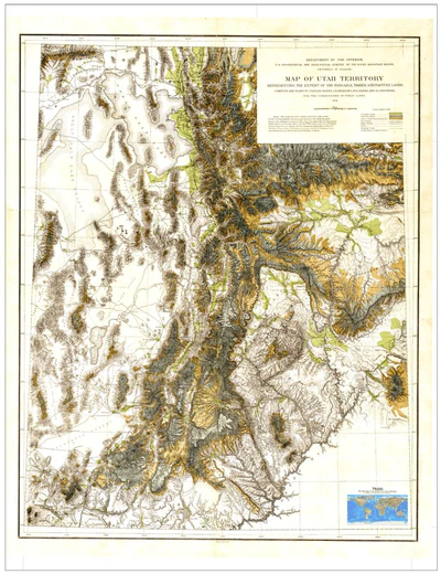
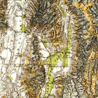
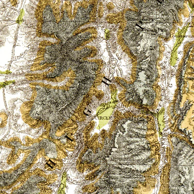
Map Of Utah Territory 1878
Representing the extent of the irrigable timber and pasture lands
Department Of The Interior
U.S. Geographical and Geological Survey of the Rocky Mountains
J.W. Powell in Charge
Compiled and Drawn by Charles Mahon, J.H. Renshawe, W.H. Graves and H. Lindenkohl
For ...
Representing the extent of the irrigable timber and pasture lands
Department Of The Interior
U.S. Geographical and Geological Survey of the Rocky Mountains
J.W. Powell in Charge
Compiled and Drawn by Charles Mahon, J.H. Renshawe, W.H. Graves and H. Lindenkohl
For ...
Geographic area:
Category:
Historical
Size:
48.72MB
Publication:
1878
Language:
English
This product is available exclusively in digital format, for use only in the Avenza Maps app.
Map bounds
Check nearby mapsWhat you get with Avenza Maps

Reliable mapping tools
Record GPS tracks, add placemarks, add photos, measure distances, and much more.

Locate yourself with GPS
Avenza Maps offline GPS app on your mobile device can locate you on any map, without WiFi or network connectivity.

The best maps by the best publishers
Download professionally curated digital maps on the Avenza Map Store from the best-renowned publishers.