


Digital map for use exclusively in the Avenza Maps app
Bundle
13
1
Monongalia County, WV Quad Maps - Bundle
WV Division of Natural Resources
- Fishing
- Hunting
Free
This bundle is comprised of all of the quad maps covering Monongalia County, West Virginia. For questions regarding these maps, please contact DNRGIS@wv.gov.
Quads included in this bundle:
Blacksville
Fairmont East
Gladesville
Grant Town
Hundred
Lake Lynn
Mannington
Masontown
Morganto...
Quads included in this bundle:
Blacksville
Fairmont East
Gladesville
Grant Town
Hundred
Lake Lynn
Mannington
Masontown
Morganto...
Geographic area:
Category:
Topographic
Size:
425.43MB
Publication:
April 2024
Language:
English
This product is available exclusively in digital format, for use only in the Avenza Maps app.
Map bounds
Maps included in this bundle
This bundle contains 13 maps
Topographic
Morgantown North Quad Topo - WVDNR
WV Division of Natural Resources
- Camping
- Fishing
- Hiking
- Hunting

Topographic
Morgantown South Quad Topo - WVDNR
WV Division of Natural Resources
- Camping
- Fishing
- Hiking
- Hunting

Topographic
Lake Lynn Quad Topo - WVDNR
WV Division of Natural Resources
- Camping
- Fishing
- Hiking
- Hunting

Topographic
Blacksville Quad Topo - WVDNR
WV Division of Natural Resources
- Camping
- Fishing
- Hiking
- Hunting
Topographic
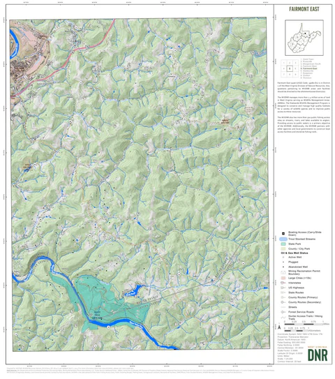
Fairmont East Quad Topo - WVDNR
WV Division of Natural Resources
- Camping
- Fishing
- Hiking
- Hunting

Customer Reviews
5.0 Based on 1 Reviews
Write a Review Ask a Question - Reviews
- Questions
Filter Reviews:
A
01/22/2025
Anonymous
United States
Exactly what I was looking for
USGS maps are the way to go. I’ve used the paper versions for years but to have your GPS location on the map while viewing and to be able to do it offline is perfect!
What you get with Avenza Maps

Reliable mapping tools
Record GPS tracks, add placemarks, add photos, measure distances, and much more.

Locate yourself with GPS
Avenza Maps offline GPS app on your mobile device can locate you on any map, without WiFi or network connectivity.

The best maps by the best publishers
Download professionally curated digital maps on the Avenza Map Store from the best-renowned publishers.