Digital map for use exclusively in the Avenza Maps app
Bundle
12
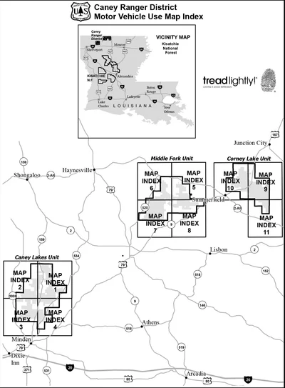
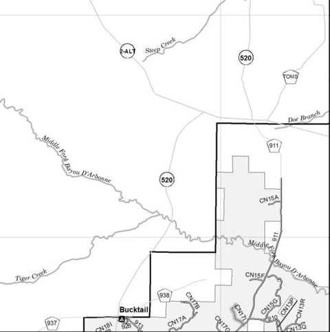
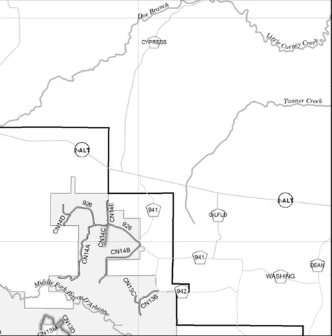
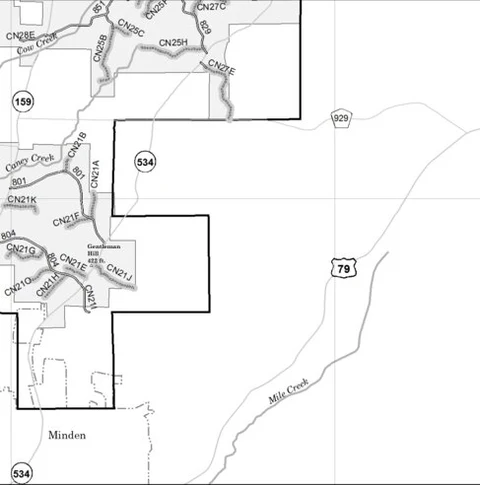
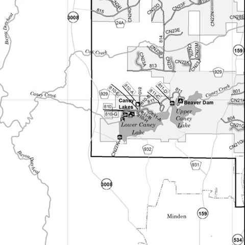
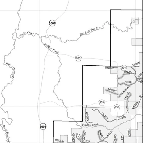
Motor Vehicle Use Map, MVUM, Caney District, Kisatchie National Forest
- Backroading
- Hiking
- Off-roading
Free
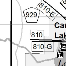
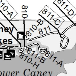
The printed USDA Forest Service Motor Vehicle Use Map (MVUM) from which this map was derived, is a free, single-purpose, black-and-white map that displays those roads, trails, and areas designated for motor vehicle use on a particular national forest or grassland. Routes not designated for motor ...
Geographic area:
Category:
Trails
Size:
3.58MB
Publication:
2020
Language:
English
This product is available exclusively in digital format, for use only in the Avenza Maps app.
Map bounds
Maps included in this bundle
This bundle contains 12 maps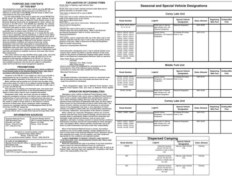
Parks & Forests
Motor Vehicle Use Map, MVUM, Caney District, Kisatchie National Forest 11
US Forest Service R8
Parks & Forests
Motor Vehicle Use Map, MVUM, Caney District, Kisatchie National Forest 10
US Forest Service R8
- Backroading
Parks & Forests
Motor Vehicle Use Map, MVUM, Caney District, Kisatchie National Forest 9
US Forest Service R8
Parks & Forests
Motor Vehicle Use Map, MVUM, Caney District, Kisatchie National Forest 8
US Forest Service R8
- Backroading
Parks & Forests
Motor Vehicle Use Map, MVUM, Caney District, Kisatchie National Forest 7
US Forest Service R8
Parks & Forests
Motor Vehicle Use Map, MVUM, Caney District, Kisatchie National Forest 6
US Forest Service R8
- Backroading
What you get with Avenza Maps

Reliable mapping tools
Record GPS tracks, add placemarks, add photos, measure distances, and much more.

Locate yourself with GPS
Avenza Maps offline GPS app on your mobile device can locate you on any map, without WiFi or network connectivity.

The best maps by the best publishers
Download professionally curated digital maps on the Avenza Map Store from the best-renowned publishers.