Digital map for use exclusively in the Avenza Maps app
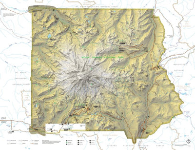
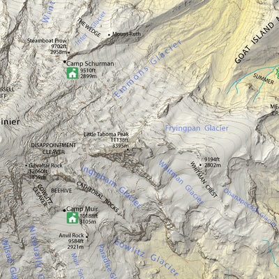
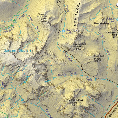
Mount Rainier National Park
- Hiking
$9.99 USD
Check this map and amazing number of details of Mt Rainier relief. Plus hiking trails and points of interest.
Geographic area:
Category:
Tourist
Size:
15.35MB
Publication:
2014
Language:
English
This product is available exclusively in digital format, for use only in the Avenza Maps app.
Map bounds
Check nearby mapsYou might also like

4
Parks & Forests
Mount Rainier National Park
US National Park Service · Publication 2017
- Hiking
Free

1
Topographic
Mount Rainier East, WA (2011, 24000-Scale)
United States Geological Survey · Publication 2011
Free

Topographic
Mount Rainier West, WA (2011, 24000-Scale)
United States Geological Survey · Publication 2011
Free

Topographic
Mount Rainier West, WA (2020, 24000-Scale)
United States Geological Survey · Publication February 2020
Free
What you get with Avenza Maps

Reliable mapping tools
Record GPS tracks, add placemarks, add photos, measure distances, and much more.

Locate yourself with GPS
Avenza Maps offline GPS app on your mobile device can locate you on any map, without WiFi or network connectivity.

The best maps by the best publishers
Download professionally curated digital maps on the Avenza Map Store from the best-renowned publishers.