

Digital map for use exclusively in the Avenza Maps app
NWON50 Lac Seul - Northwestern Ontario Topo
- Cycling
- Fishing
- Hiking
- Hunting
- Skiing
This product can also be purchased as part of the following bundle(s).
$1.99 USD
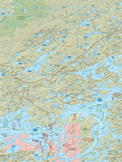
This recreation topographic map for Lac Seul highlights all the logging/resource roads, hunting areas, fishing lakes & streams, campsites, paddling routes for canoeing and kayaking, wildlife viewing areas, multi-use trails for hiking, biking, horseback riding, cross-country skiing and snowsho...
Geographic area:
Category:
Parks & Forests
Size:
7.74MB
Publication:
2021
Language:
English
This product is available exclusively in digital format, for use only in the Avenza Maps app.
Map bounds
Check nearby mapsWhat you get with Avenza Maps

Reliable mapping tools
Record GPS tracks, add placemarks, add photos, measure distances, and much more.

Locate yourself with GPS
Avenza Maps offline GPS app on your mobile device can locate you on any map, without WiFi or network connectivity.

The best maps by the best publishers
Download professionally curated digital maps on the Avenza Map Store from the best-renowned publishers.