

Digital map for use exclusively in the Avenza Maps app
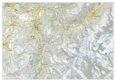
Saint Gervais Nord 1:25.000
- Cycling
- Hiking
- Orienteering
This product can also be purchased as part of the following bundle(s).
$8.99 USD
Saint Gervais North hiking map at a 1:25.000 scale with a WGS84 grid (1km). All data has been gathered by walking each route with a GPS device. It covers also the area of the southern Tour du Mont Blanc.
Category:
Parks & Forests
Size:
137.68MB
Publication:
June 2025
Language:
English, French, German, Italian
This product is available exclusively in digital format, for use only in the Avenza Maps app.
Map bounds
Check nearby mapsWhat you get with Avenza Maps

Reliable mapping tools
Record GPS tracks, add placemarks, add photos, measure distances, and much more.

Locate yourself with GPS
Avenza Maps offline GPS app on your mobile device can locate you on any map, without WiFi or network connectivity.

The best maps by the best publishers
Download professionally curated digital maps on the Avenza Map Store from the best-renowned publishers.