

Digital map for use exclusively in the Avenza Maps app
Bundle
3
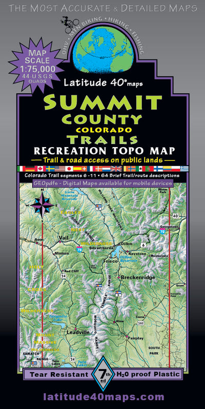
Summit County Trails Map - 7th edition
- Backroading
- Camping
- Cycling
- Hiking
- Off-roading
$14.99 USD
Anyone who has explored the backcountry in Summit County uses this two sided, three map "Go To" bundle for trail and route navigation available for devices to compliment the printed map. A favorite map of Summit County Search and Rescue. Map scale is 1:75,000 or 1"=1.2 miles. An inset of Breckenr...
Geographic area:
Category:
Trails
Size:
141.79MB
Publication:
April 2022
Language:
English
This product is available exclusively in digital format, for use only in the Avenza Maps app.
Map bounds
Maps included in this bundle
This bundle contains 3 maps
Trails
GeoPDF Summit Co-7th ed-Breck inset-lw-nh
Latitude 40° maps
- Backroading
- Camping
- Cycling
- Hiking
- Off-roading

Trails
GeoPDF Summit Co-7th ed-North reduced
Latitude 40° maps
- Backroading
- Camping
- Cycling
- Hiking
- Off-roading

Trails
GeoPDF Summit Co-7th ed-South-1-reduced-2
Latitude 40° maps
- Backroading
- Camping
- Cycling
- Hiking
- Off-roading
What you get with Avenza Maps

Reliable mapping tools
Record GPS tracks, add placemarks, add photos, measure distances, and much more.

Locate yourself with GPS
Avenza Maps offline GPS app on your mobile device can locate you on any map, without WiFi or network connectivity.

The best maps by the best publishers
Download professionally curated digital maps on the Avenza Map Store from the best-renowned publishers.