Digital map for use exclusively in the Avenza Maps app
Bundle
17
The Otways
$14.99 USD
A topographic map bundle covering the Great Otway National Park and Otway Forest Park, consisting of 17 maps at 1:25,000 scale. (Refer to individual maps for a description of their content.)
Geographic area:
Category:
Topographic
Size:
459.96MB
Publication:
2016
Language:
English
This product is available exclusively in digital format, for use only in the Avenza Maps app.
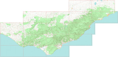
Map bounds
Maps included in this bundle
This bundle contains 17 maps


What you get with Avenza Maps

Reliable mapping tools
Record GPS tracks, add placemarks, add photos, measure distances, and much more.

Locate yourself with GPS
Avenza Maps offline GPS app on your mobile device can locate you on any map, without WiFi or network connectivity.

The best maps by the best publishers
Download professionally curated digital maps on the Avenza Map Store from the best-renowned publishers.