Avenza Maps Web: Streamlining GIS Data Distribution for Field Operations
In today’s fast-moving enterprise environment, managing and distributing geospatial data efficiently is crucial for field operations. That’s why we’re excited to introduce Avenza Maps Web, a platform built to simplify how organizations handle mapping content. With the ability to upload custom maps, organize data, and share it seamlessly with field teams, Avenza Maps Web ensures that vital information is always accessible, helping you stay organized and focused on the task at hand.
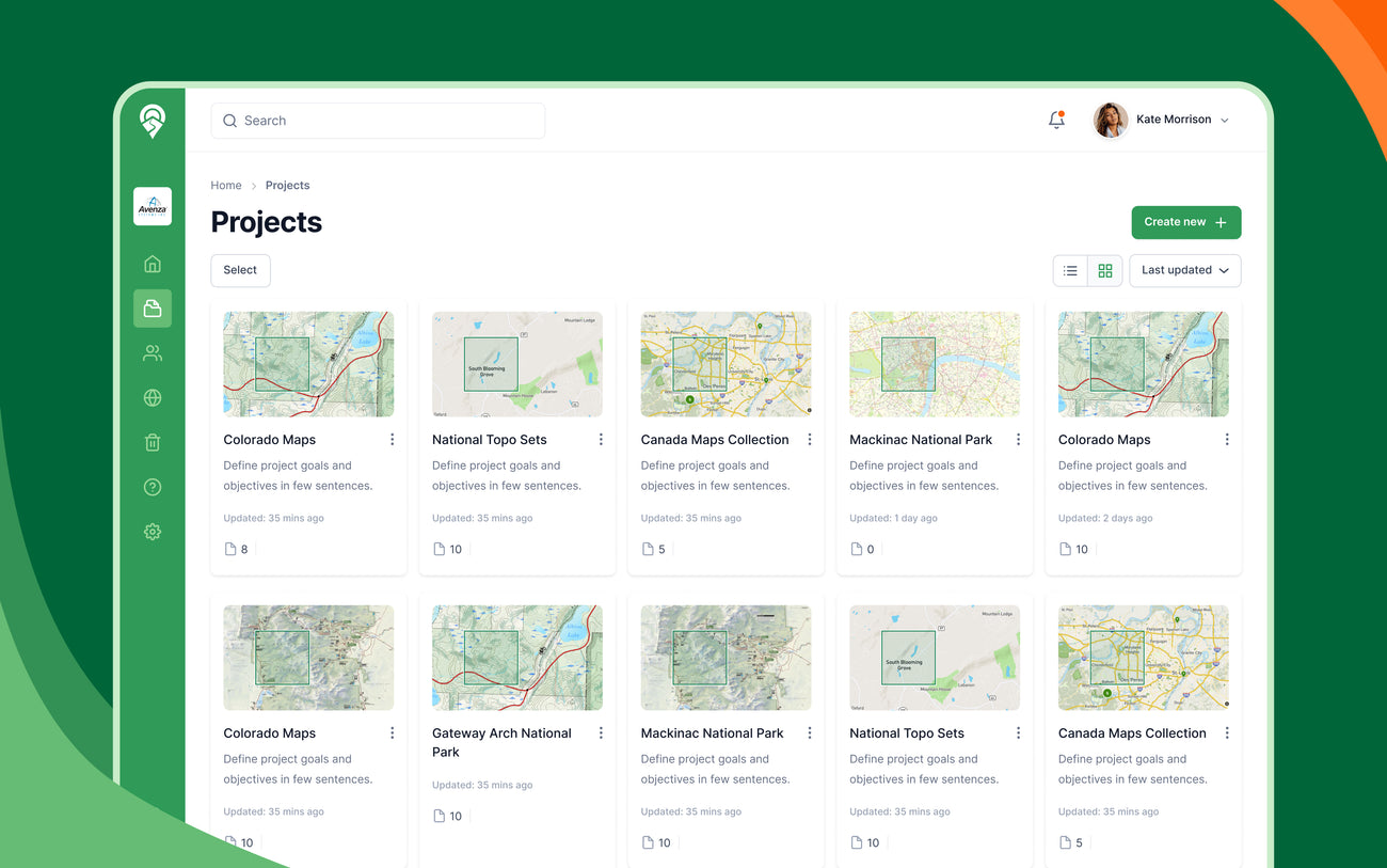
Centralized Project Management
Managing multiple field operations can be challenging without a structured approach to data organization,and that’s where the new Projects feature in Avenza Maps Web comes in. Designed to simplify how you manage mapping content, Projects lets you group relevant maps and files by specific work orders or geographic locations. This centralized system not only helps you stay organized when juggling multiple tasks but also enhances team collaboration, reduces redundancy, and ensures everyone has access to the most up-to-date information they need to get the job done efficiently.
Efficient Map Upload and Management
Uploading and managing maps in Avenza Maps Web has never been easier. The platform now provides a more intuitive and transparent upload process, giving users clear status updates at every step, indicating whether a file is still processing, has been uploaded as a draft, or needs attention. If something goes wrong, there’s no need to start over, users can simply replace the file and try again. Files can also be renamed directly from the dashboard, helping users keep their content organized. Unlike the Avenza Maps Map Store, there’s no review process by Avenza staff, content becomes available as soon as it's uploaded and processed.
Seamless Data Sharing with Field Teams
Sharing maps with field teams is now simpler and more efficient with Avenza Maps Web. Once maps are uploaded and processed, the platform automatically generates QR codes and dynamic links that can be scanned within the Avenza Maps app, allowing users to instantly download the necessary maps. This feature ensures that teams have immediate access to up-to-date maps, even in remote areas without internet connectivity.

Custom Symbology
Understanding that different projects may require specific symbols for clarity, Avenza Maps Web supports custom symbology, allowing organizations to upload and use their own symbols to tailor maps for specific tasks or projects. This customization helps highlight critical features such as infrastructure, hazards, or points of interest, enhancing the clarity and usefulness of maps for field operations.
What’s Next?
Avenza Maps Web is committed to evolving with our users' needs, offering a scalable, user-centric platform that optimizes field workflows. The current features lay a solid foundation for an efficient, flexible solution, tailored to how you work in the field. And the best part? We're just getting started. Future enhancements will focus on further improving flexibility, efficiency, and integration capabilities to support complex enterprise operations. Stay tuned for more!