Do you ever wonder what local history is around you? Did you watch Indiana Jones with dreams of becoming an archaeologist? Learning what artifacts and buildings existed in our towns long before us can be fascinating. Luckily, the Map Store is home to a great selection of historical maps. One of the biggest collections of historical maps covers the area of Sweden!
This month's featured publisher is Sweden-based Historiska GIS-kartor, also known as Historical GIS Maps, which Göran Bengtsson created. Göran has always been interested in archaeology and specialized in the Late Paleolithic Stone Age at the University of Gothenburg. More recently, he’s been focusing on historical maps of Sweden to add to the historical archaeology of the area.
Göran started taking cartography more seriously three years ago because he had to inventory the number of historical watermills that existed in Halland County, in Sweden. “So far, I have rectified over 2500 maps and identified approximately 3000 mills,” he tells us. “A preliminary calculation shows that we may have had over 5000 mills in the Halland County alone. In the past year and as a spin-off result, local researchers have realized the value of the rectified maps that I provide.”
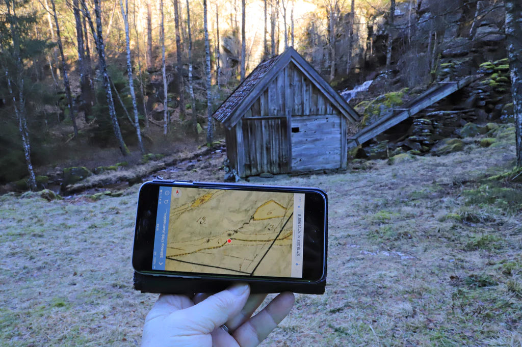
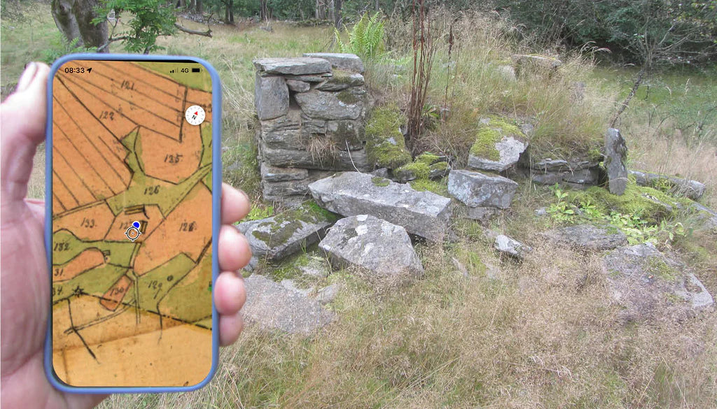
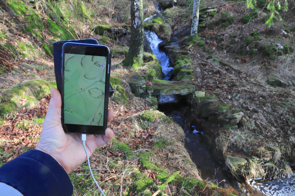
People love maps for many reasons, and a common one, especially surrounding historical maps, is that they show the changes in the landscape over time. Göran feels the same way: "By switching between maps of different ages, you can clearly see the settlement patterns change over time. Another advantage is that you can extract GPS coordinates to the various locations with high accuracy directly from Avenza Maps.”
Göran was introduced to Avenza Maps by a good friend, who is an archaeologist and historical, and cultural geographer. Göran also works with archaeologists, art and culture specialists, homeland researchers and authorities that need cartographic work. He’s also led several course activities where he taught students to use Avenza Maps in the field. “My goal with Historical GIS Maps is that homeland researchers all over Sweden will embrace the advantages of historical maps and Avenza Maps,” Göran says.
Another very large area of use for historical maps is for genealogists, not only in Sweden but wherever relatives have moved. With the help of a historical map and Avenza Maps, people can find the birthplaces of their relatives.
“My favourite part of creating maps is that I learn so much of our history through historical maps,” Göran happily tells us. “Here, Sweden has the unique advantage of our gigantic map archive, with over 3 million digitized maps. But without Avenza Maps as the carrier of the maps, the archives would have been useless and meaningless.”
What’s next for Historiska GIS-kartor? “The idea of using historical maps in homeland research is spreading throughout Sweden, and Historical GIS Maps is now considered to be fairly established across the country,” Göran says. “With the help of a map installed in the mobile phone, these can find the birthplaces of their relatives regardless of whether there are buildings left or if only ruins remain on the site.”
You can find all of Historiska GIS-kartor’s maps in the Map Store here!