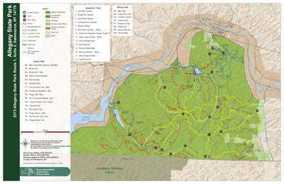


Allegany State Park Trail Map
- Cycling
- Fishing
- Hiking
- Skiing
- Snowmobiling
This product is available exclusively in digital format, for use only in the Avenza Maps app.
Map bounds
Check nearby maps- Reviews
- Questions
- map program
- state park
- time
- park
- GPS dot
- elevation gain
- descriptions
- contours
- trail
- watch GPS
Too hard to see - poor resolution. minimal markings
Works well, elevation notes would be helpful
Map worked well. It would have helped to have elevation notations on the contours so you know how much elevation gain to expect on a hike. For the first time visiting the park, I was glad to have the GPS dot overlaid on the map following along as I hiked. I questioned the trail length descriptions though as they didn’t match my watch GPS.
Works great. I have found it very reliable and helpful
What you get with Avenza Maps

Reliable mapping tools
Record GPS tracks, add placemarks, add photos, measure distances, and much more.

Locate yourself with GPS
Avenza Maps offline GPS app on your mobile device can locate you on any map, without WiFi or network connectivity.

The best maps by the best publishers
Download professionally curated digital maps on the Avenza Map Store from the best-renowned publishers.