
Digital map for use exclusively in the Avenza Maps app
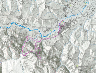
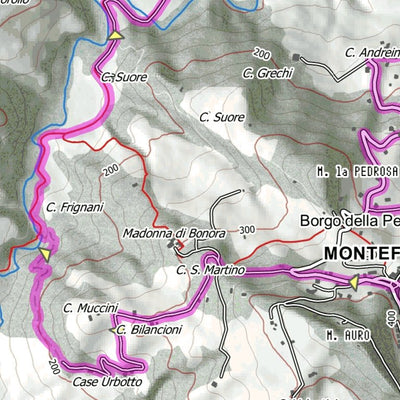
Da Morciano di Romagna a Montefiore Conca
- Hiking
Free
L’itinerario inizia da Morciano di Romagna e conduce sino al castello di Montefiore Conca
Dati tecnici
Lunghezza: 20.4km
Dislivello in salita/discesa: 550m / 550m
Tipo di itinerario: LOOP (anello)
http://www.outdoor365.it/da-morciano-di-romagna-a-montefiore-conca-itinerario-accessibile
Dati tecnici
Lunghezza: 20.4km
Dislivello in salita/discesa: 550m / 550m
Tipo di itinerario: LOOP (anello)
http://www.outdoor365.it/da-morciano-di-romagna-a-montefiore-conca-itinerario-accessibile
Geographic area:
Category:
Parks & Forests
Size:
7.71MB
Publication:
March 2018
Language:
Italian
This product is available exclusively in digital format, for use only in the Avenza Maps app.
Map bounds
Check nearby mapsWhat you get with Avenza Maps

Reliable mapping tools
Record GPS tracks, add placemarks, add photos, measure distances, and much more.

Locate yourself with GPS
Avenza Maps offline GPS app on your mobile device can locate you on any map, without WiFi or network connectivity.

The best maps by the best publishers
Download professionally curated digital maps on the Avenza Map Store from the best-renowned publishers.