Colorado Peaks, Passes, & Parks
- Backroading
- Camping
- City Tours
- Hiking
- Hunting
This product can also be purchased as part of the following bundle(s).
Free
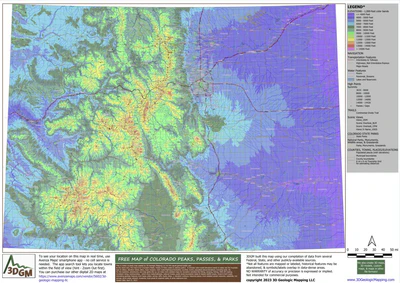
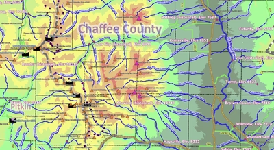
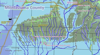
Covering all of Colorado, this interesting, yet basic map focuses on Peaks, Passes, and Parks (state parks & National parks/monuments/grasslands). Other map features include scenic views, primary streams/lakes, main roads/highways/interstates, towns & populated places/elevations, 6 mile ...
Geographic area:
Category:
Topographic
Size:
64.08MB
Publication:
2023
Language:
English

This product is available exclusively in digital format, for use only in the Avenza Maps app.
Map bounds
Check nearby mapsWhat you get with Avenza Maps

Reliable mapping tools
Record GPS tracks, add placemarks, add photos, measure distances, and much more.

Locate yourself with GPS
Avenza Maps offline GPS app on your mobile device can locate you on any map, without WiFi or network connectivity.

The best maps by the best publishers
Download professionally curated digital maps on the Avenza Map Store from the best-renowned publishers.