Digital map for use exclusively in the Avenza Maps app
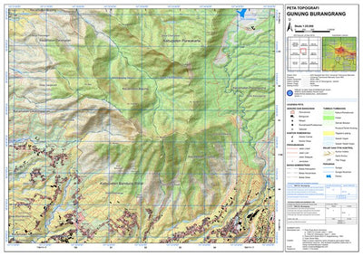
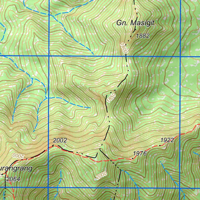
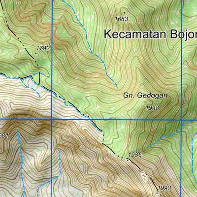
Gunung Burangrang
- Camping
- Cycling
- Hiking
- Orienteering
- Surveying
Free
Peta Topografi Gunung Burangrang yang dikompilasi dari peta Rupa Bumi Indonesia NLP: 1209-313 Cimahi tahun 2001 dan 1209-331 Wanayasa tahun 2000.
Update batas administrasi tahun 2023 bersumber dari Badan Informasi Geospasial, bangunan, jalan bersumber dari Open Street Map tahun 2023 dan tamba...
Update batas administrasi tahun 2023 bersumber dari Badan Informasi Geospasial, bangunan, jalan bersumber dari Open Street Map tahun 2023 dan tamba...
Category:
Topographic
Size:
21.3MB
Publication:
December 2023
Language:
Indonesian
This product is available exclusively in digital format, for use only in the Avenza Maps app.
Map bounds
Check nearby mapsWhat you get with Avenza Maps

Reliable mapping tools
Record GPS tracks, add placemarks, add photos, measure distances, and much more.

Locate yourself with GPS
Avenza Maps offline GPS app on your mobile device can locate you on any map, without WiFi or network connectivity.

The best maps by the best publishers
Download professionally curated digital maps on the Avenza Map Store from the best-renowned publishers.