Digital map for use exclusively in the Avenza Maps app
1
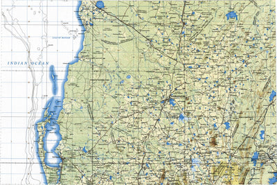
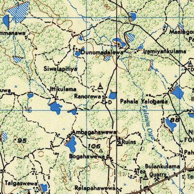
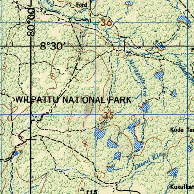
JOG - nc-44-14-1-ground
Land Info Worldwide Mapping LLC
- Flying
$4.99 USD
Joint Operational Chart (JOG) provided by LandInfo Worldwide Mapping LLC.
1:250,000 scale in Lambert Conformal Conic projection.
1:250,000 scale in Lambert Conformal Conic projection.
Category:
Aeronautical
Size:
42.45MB
Publication:
2017
Language:
English
This product is available exclusively in digital format, for use only in the Avenza Maps app.
Map bounds
Check nearby maps Customer Reviews
4.0 Based on 1 Reviews
Write a Review Ask a Question - Reviews
- Questions
Filter Reviews:
C
10/28/2021
Customer
Dehiwala, Western Province, Sri Lanka
Very Helpful!
This was very helpful for me to do my research work recently.
What you get with Avenza Maps

Reliable mapping tools
Record GPS tracks, add placemarks, add photos, measure distances, and much more.

Locate yourself with GPS
Avenza Maps offline GPS app on your mobile device can locate you on any map, without WiFi or network connectivity.

The best maps by the best publishers
Download professionally curated digital maps on the Avenza Map Store from the best-renowned publishers.