Digital map for use exclusively in the Avenza Maps app
2
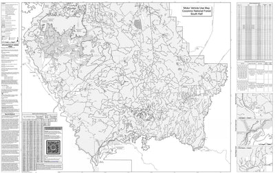
Motor Vehicle Use Map, Coconino National Forest (South)
- Backroading
- Off-roading
Free
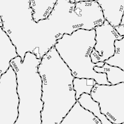
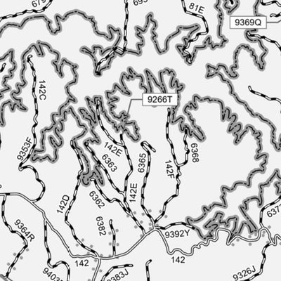
The printed USDA Forest Service Motor Vehicle Use Map (MVUM) from which this map was derived, is a free, single-purpose, black-and-white map that displays those roads, trails, and areas designated for motor vehicle use on a particular national forest or grassland. Routes not designated for motor ...
Geographic area:
Category:
Trails
Size:
65.36MB
Publication:
April 2023
Language:
English
This product is available exclusively in digital format, for use only in the Avenza Maps app.
Map bounds
Check nearby maps Customer Reviews
5.0 Based on 2 Reviews
Write a Review Ask a Question - Reviews
- Questions
Filter Reviews:
A
07/01/2024
Anonymous
I recommend this product
Nice map
It had all the details I needed for a recent dispersed camping trip.
A
06/09/2024
Anonymous
I recommend this product
Works very well
I enjoyed it. Helped find roads not listed on a map
What you get with Avenza Maps

Reliable mapping tools
Record GPS tracks, add placemarks, add photos, measure distances, and much more.

Locate yourself with GPS
Avenza Maps offline GPS app on your mobile device can locate you on any map, without WiFi or network connectivity.

The best maps by the best publishers
Download professionally curated digital maps on the Avenza Map Store from the best-renowned publishers.