
Digital map for use exclusively in the Avenza Maps app
4
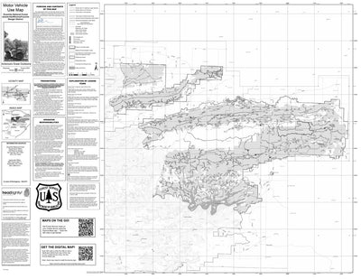
Motor Vehicle Use Map, MVUM, Jessieville Winona Fourche District, Ouachita National Forests
- Backroading
Free
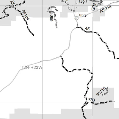
The printed USDA Forest Service Motor Vehicle Use Map (MVUM) from which this map was derived, is a free, single-purpose, black-and-white map that displays those roads, trails, and areas designated for motor vehicle use on a particular national forest or grassland. Routes not designated for motor ...
Geographic area:
Category:
Parks & Forests
Size:
27.93MB
Publication:
April 2025
Language:
English
This product is available exclusively in digital format, for use only in the Avenza Maps app.
Map bounds
Check nearby maps Customer Reviews
5.0 Based on 4 Reviews
Write a Review Ask a Question - Reviews
- Questions
Filter Reviews:
- GPS location indicator
- track
- cell phone service
11/26/2022
Anonymous
I recommend this product
Mt Magazine, AR ATV trails
Very easy to use and track. Enjoyed the app and map.
09/23/2022
Anonymous
I recommend this product
Great product
The GPS location indicator of where you are at on the map what is very accurate. Great to not have to depend on cell phone service.
C
11/08/2021
Customer
Hot Springs Village, Arkansas, United States
Awesome
A+, great app! No issues, works like a charm friends.
What you get with Avenza Maps

Reliable mapping tools
Record GPS tracks, add placemarks, add photos, measure distances, and much more.

Locate yourself with GPS
Avenza Maps offline GPS app on your mobile device can locate you on any map, without WiFi or network connectivity.

The best maps by the best publishers
Download professionally curated digital maps on the Avenza Map Store from the best-renowned publishers.