Digital map for use exclusively in the Avenza Maps app
17
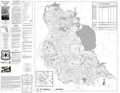
Motor Vehicle Use Map, MVUM, Ocala National Forest
- Off-roading
Free
**Note** Inset maps are not georeferenced
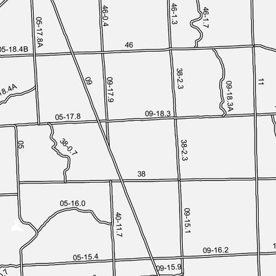
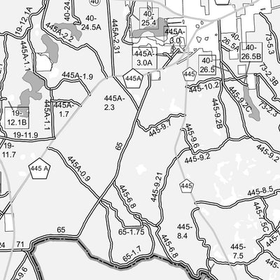
The printed USDA Forest Service Motor Vehicle Use Map (MVUM) from which this map was derived, is a free, single-purpose, black-and-white map that displays those roads, trails, and areas designated for motor vehicle use on a particular national forest o...
The printed USDA Forest Service Motor Vehicle Use Map (MVUM) from which this map was derived, is a free, single-purpose, black-and-white map that displays those roads, trails, and areas designated for motor vehicle use on a particular national forest o...
Geographic area:
Category:
Trails
Size:
13.77MB
Publication:
January 2022
Language:
English
This product is available exclusively in digital format, for use only in the Avenza Maps app.
Map bounds
Check nearby maps Customer Reviews
5.0 Based on 17 Reviews
Write a Review Ask a Question - Reviews
- Questions
Filter Reviews:
- trails
- Ocala National Forest
- spot
- wife
- confidence
- iPhone
- times
- number
- area
- internet
A
08/12/2024
Anonymous
I recommend this product
Much needed map
This is pretty great but need to learn the features
A
04/09/2024
Anonymous
I recommend this product
Works great
Just what I needed can’t believe that it’s free. Every dirt road rider should have this.
A
12/11/2023
Anonymous
I recommend this product
Ocala forest map
Used the map today and was very detailed
What you get with Avenza Maps

Reliable mapping tools
Record GPS tracks, add placemarks, add photos, measure distances, and much more.

Locate yourself with GPS
Avenza Maps offline GPS app on your mobile device can locate you on any map, without WiFi or network connectivity.

The best maps by the best publishers
Download professionally curated digital maps on the Avenza Map Store from the best-renowned publishers.