

Digital map for use exclusively in the Avenza Maps app
Obsolete - Emery County OHV Trail Map - Back
- Off-roading
Free
MAP INFORMATION
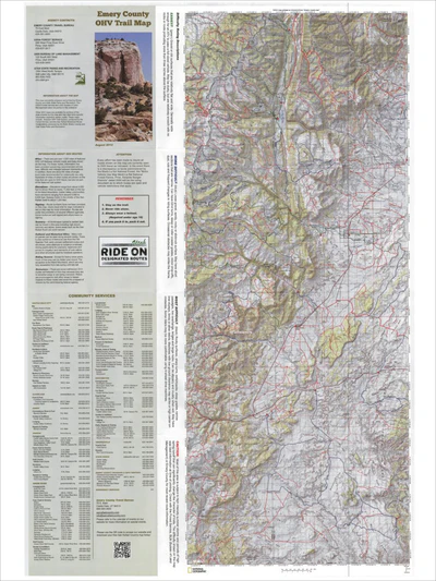
This map was jointly prepared and printed by Emery County and Utah State Parks and Recreation. The USDA Forest Service and USDI Bureau of Land Management were not parties to this endeavor.
Other OHV maps are available for portions of the area covered by this map and may off...
This map was jointly prepared and printed by Emery County and Utah State Parks and Recreation. The USDA Forest Service and USDI Bureau of Land Management were not parties to this endeavor.
Other OHV maps are available for portions of the area covered by this map and may off...
Geographic area:
Category:
Trails
Size:
135.95MB
Publication:
August 2013
Language:
English
This product is available exclusively in digital format, for use only in the Avenza Maps app.
Map bounds
Check nearby mapsWhat you get with Avenza Maps

Reliable mapping tools
Record GPS tracks, add placemarks, add photos, measure distances, and much more.

Locate yourself with GPS
Avenza Maps offline GPS app on your mobile device can locate you on any map, without WiFi or network connectivity.

The best maps by the best publishers
Download professionally curated digital maps on the Avenza Map Store from the best-renowned publishers.