
Digital map for use exclusively in the Avenza Maps app
1
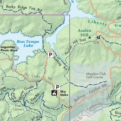
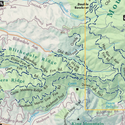
OneTam Trail Map - Mt. Tamalpais
Golden Gate National Parks Conservancy
- Cycling
- Hiking
Free
Trail map of OneTam, an initiative of the Tamalpais Land Collaborative. Oriented with southwest at the top, the area of focus radiates from the top of Mount Tam to include all of Mount Tamalpais State Park, Muir Woods National Monument, and Marin Municipal Water District lands on Mt. Tam. It als...
Geographic area:
Category:
Parks & Forests
Size:
9.71MB
Publication:
January 2015
Language:
English
This product is available exclusively in digital format, for use only in the Avenza Maps app.
Map bounds
Check nearby maps Customer Reviews
2.0 Based on 1 Reviews
Write a Review Ask a Question - Reviews
- Questions
Filter Reviews:
C
10/26/2021
Customer
Rancho Cordova, California, United States
The trails layer is a little off so intersections weren't aligning, which made it difficult for navigation. Great reference but use as a secondary map, not primary
What you get with Avenza Maps

Reliable mapping tools
Record GPS tracks, add placemarks, add photos, measure distances, and much more.

Locate yourself with GPS
Avenza Maps offline GPS app on your mobile device can locate you on any map, without WiFi or network connectivity.

The best maps by the best publishers
Download professionally curated digital maps on the Avenza Map Store from the best-renowned publishers.