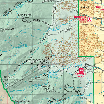


Digital map for use exclusively in the Avenza Maps app
2
Inyo National Forest (South)
- Camping
- Hiking
$4.99 USD
National Forest Visitor Maps provide an overview of recreational uses, trails, roads, streams, lakes, landforms, land administration, visitor centers, facilities, campgrounds and picnic areas. The 18 National Forests in the Pacific Southwest Region (Region 5) are mapped at the scale of 1/2 inch p...
Geographic area:
Maps of California, United States
Maps of Giant Sequoia National Monument
Maps of Golden Trout Wilderness
Maps of Inyo Mountains Wilderness
Maps of John Muir Wilderness
Maps of Kings Canyon National Park
Maps of Sequoia National Park
Maps of Sequoia-Kings Canyon Wilderness
Maps of the United States
Maps of Tulare (County), California
Maps of Yolo (County), California
Category:
Parks & Forests
Size:
40.52MB
Publication:
2022
Language:
English
This product is available exclusively in digital format, for use only in the Avenza Maps app.
Map bounds
Check nearby maps Customer Reviews
4.5 Based on 2 Reviews
Write a Review Ask a Question - Reviews
- Questions
Filter Reviews:
- version
- paper map
- phone
A
10/23/2024
Anonymous
I recommend this product
Inyo Coverage
I measured potential hikes, I tracked hikes, I timed hikes, and I checked my elevation gain and loss. Avenza and this map are both winners✔️
A
04/21/2024
Anonymous
I recommend this product
Works ok
Map is as expected on the phone. I'm disappointed that there is not a version for pc. I'm going to buy the paper map.
What you get with Avenza Maps

Reliable mapping tools
Record GPS tracks, add placemarks, add photos, measure distances, and much more.

Locate yourself with GPS
Avenza Maps offline GPS app on your mobile device can locate you on any map, without WiFi or network connectivity.

The best maps by the best publishers
Download professionally curated digital maps on the Avenza Map Store from the best-renowned publishers.